Distance: 2 miles Time: 1 hr Level: Easy Terrain: Good path, pavement and road Access: Arrive by car there is plenty of parking at the Speybay dolphin centre IV32 7PJ (donations for parking)
This is a fab short circuit walk from Speybay via the Spey viaduct. The walk is all on the flat with a good path so family and buggy friendly!
Route: From the car park head for the information board and you will see the path to the left that runs along the side of the river. Head along the path over the wooded footbridge and keep going!
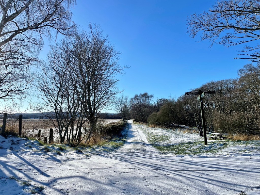
You will follow this path all the way along till you come a 4 way junction. Take the road to the right just before the sign to take you along to the banks of the river and to get a great view of the viaduct.
To return back to Speybay. Go back to the junction and take the track that takes you to the main road. When you get to the main road cross the road on the the pavement and take a left back towards Speybay.
Once you are back to Speybay take a left at the Bay golf club and head back to the carpark.
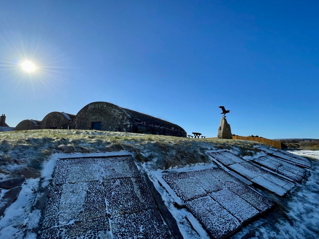
This is a beautiful trail that not only takes you along a section of the River Spey it gives you a chance to see the remains of a very interesting hydro scheme that was way ahead of its time dating back to the early 20th century, the initiative came from the Duke of Richmond and Gordon who for some years envisaged his Castle being lit by electricity.
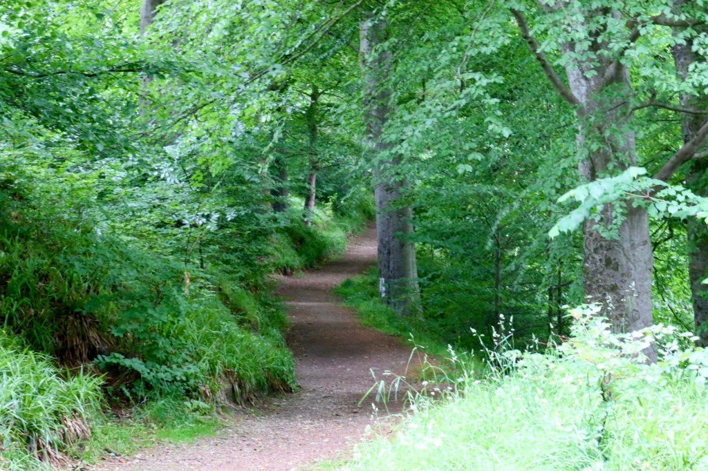
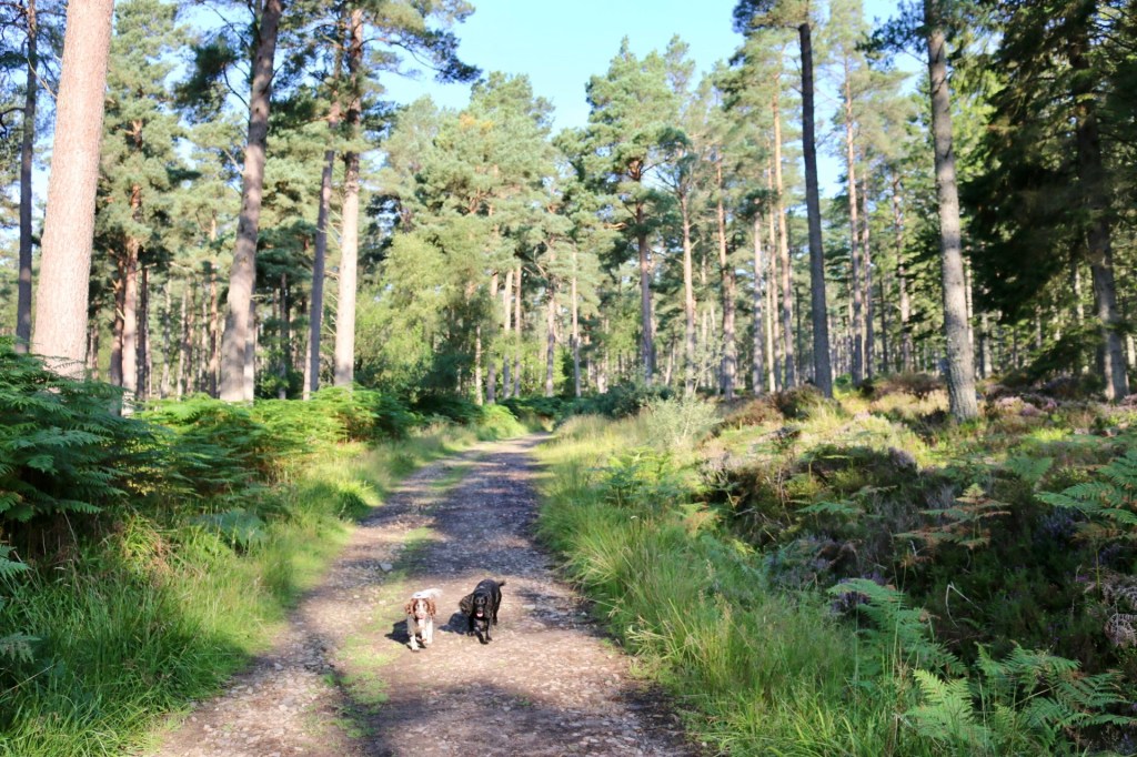
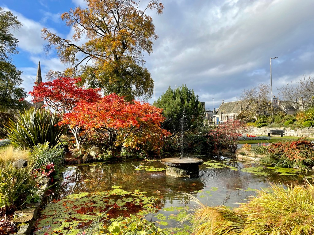
View of the River Spey
Distance: 2 ¾ miles Time: 1hr Level: Easy low-level walk Terrain: Well walked woodland paths with some tarred and pavement walking. Access: Arrive by car, parking is available at the Speyside Way car park opposite the opening of Gordon Castle at IV32 7EH. There are also good bus links from Stagecoach with a stop near the start of the walk.
Route: At the car park take a left and head towards the memorial gardens where you get an amazing, framed view of the River Spey. To the left you will see some steps, go down them and follow the path along. There is a small opening if you want to get a good view of the fish ladder. Back on the path go over the footbridge at the fish ladder you will see the signpost to the Intake.
Footbridge at the salmon ladder
Once over the footbridge you will pass some big houses, then there is a fork in the road, take the right fork towards the wooded area. Once on the wood track you will see a wayward marker post, just after you pass it take the opening to the right on the narrower path. This is where you will first see the derelict canal. The path can be quite uneven here and wet but well worth walking and getting dubby boots for.
Old canal
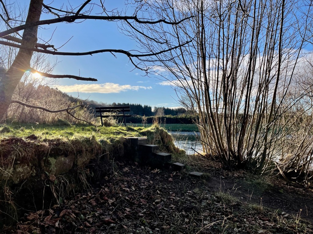
Keep on this path, it will eventually come to the edge of the river where you will get some great views of Ben Aigan in the distance. Follow the path right along the river and you will come to some steps and a bench. This is a great place to stop for a picnic and do some bird spotting on the river.
Just at the intake
Just beyond the bench you will see a wee opening and a little overgrown path where you will find an information board and the intake where the water came in to power the scheme. You still see the grid that was put there to keep fish and debris out. The water ran along the lade (known as the ‘Canal’) to the power station to drive the turbines to produce the electricity.
Head back to the bench there is a path at the right that will take you along beside the edge of the canal. Keep your eyes peeled along here as there are several scrap cars buried in the undergrowth in the canal which were dumped many years ago. Keep on the same path it will take you back to the wayward marker post where you turned off.
Scarp cars
Once back on to the tarred road, at the fork keep right, when you get to the shed at the end of the road turn right on to West St. Halfway along you will see a waterfall on the Burn of Fochabers and a wooden foot bridge running over it. Go over the bridge then take the next right on to George St. This will take you to Fochabers Square. On the other side of the road opposite the fountain you will see a large streetlamp that commemorates the opening of the scheme. Which is a great way to finish the walk.
From the square you can just go along the High St past the traffic lights and bowling green and you will return to the carpark. There are a few cafes on the High St and a lovely ice-cream shop if you fancy some refreshments after your adventure.
The route takes you through the Den woods, the Falls of Tarnash then on to Dunnyduff woods with a great viewpoint of Keith.
Distance: 3.5 miles Time: 1.5-2 hours Level: Easy with some elevation Terrain: Some pavement walking at start and finish and well-trodden wood paths. Be careful, as round the falls can be slippery when wet. Access: Arrive by car or public transport. Good train and bus links between Aberdeen and Inverness.Parking available at Reidhaven Square, Keith AB55 5AB
Route: The walk starts in Reidhaven Square where you head down toward the building in the middle (what used to be the public toilets/bus shelter)then take a right when you get on to Moss Street.Walk along to the end and at the last house carefully cross the road – it can be busy.
Track through Den woods
Walk round the right of Dusty’s customs shop and you will see Old Den Road to the right lined with trees. Start walking along there till you pass the last house (Innesfree) and up to the left you will see the path on the left to take you in to the Den woods.
Follow this path right through the woods for about ¾ mile. Please note if you have a dog and they are off the lead there is a section that is close to the road.
Falls of Tarnash
You will come to a signpost to the right for Falls of Tarnash and Dunnyduff woods. Take this path going over the wee steen bridge and keep going and you will soon come to the Falls. Make sure you explore a bit round here and take plenty of photos on a nice day as it’s a lovely spot for a picnic and even a paddle.
On the way to Dunnyduff
Get back on to the path and there is a sign post up to the left to Dunnyduff woods. There is a wee bit of elevation here but nothing too taxing.
Follow the path which does zig zag a little and keep in the path where you will come to a wee bridge with a handrail. Go straight on here and there is another wee bridge with a handrail: just keep going over the wee bridge following the well-made path. You will come to a bit of clearing where there is a great viewpoint of Keith and Newmill to the left.
Viewing area
The path continues and you will eventually come to steps to descend till you reach a forestry track take a left here. You will come through the carpark and on to the minor road.
Here you can take a left and follow the minor road back or just across the road from the carpark there is an opening and a path that runs alongside the Burn of Drum. This path can be very overgrown in the summer but it’s a great place to see wildlife such as red squirrel and birds as well as lots of wildflowers. I also spotted a buzzard along here too.
Whatever way you decide to go you will come to a bridge to go over and you head up the road till you come to a junction. Take a right here on to Edindiach Road heading back in to Keith. The road turns to the left on to Balloch Road and you will see the square ahead and the end of the walk.
This is a interesting and possible slighty creepy place to visit near Fochabers! Details of the stone below is from the information board at the stone!
Jean Carr stone information board.
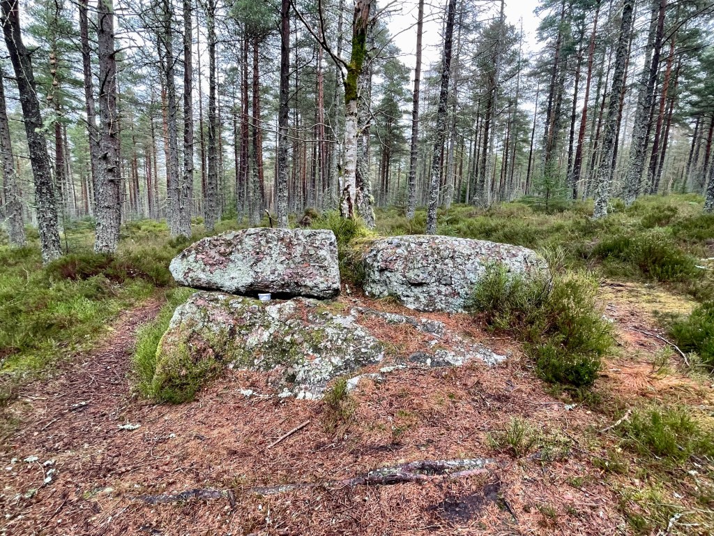
The stone is a large conglomerate boulder left from the ice age I million years ago and has probably lain here more or less unnoticed until the arrival of Jean Carr in the 18th century.
The story goes, although only pieces remain, that a young girl named Jean Carr was, to quote a sentence from old records, “Fan she wis a lassie, she was chained in the hoose by her father, an fan he dee’t, Jean said there wis two prisoners relieved.”
After this she fled, took to the open road and led the life of a gypsy, becoming a familiar figure in the area between Banff and Fochabers.
She led this happy life under the stars until the birth of her child. The local authorities snatched the child and housed it for safety with the village nurse. In an attempt to recover the child Jean tore at the thatched roof of the nurse’s home, only to be arrested and put in jail. After this incident the child was never seen again and Jean, now childless took to helping herself to other people’s, becoming a known nuisance in the local towns. At night Jean would seek the shelter of the great rock.
Jean Carr stone
“Lock up your bairns, Jean Carr’s in toon!” was the cry when she descended on Fochabers!
Some time later it was announced in a local paper that her son had died and Jean’s life was never the same again. At nights she would be seen disappearing in to the countryside and for many years took refuge under this stone. She was still seen wandering the byways as an old frail woman until one morning she was found, wrapped in her tattered shawl, lying in her favourite place under the ancient friendly rock cold and dead.
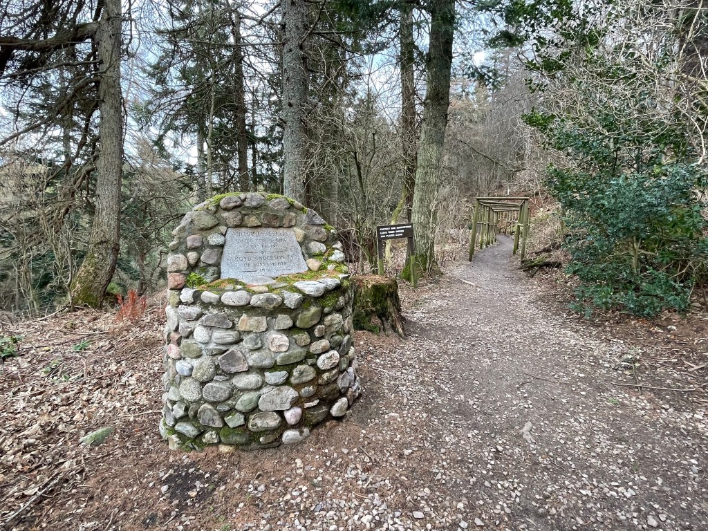
Distance: 2 1/4 miles Time: 1-1 1/2hrs Level: Easy with elevation Terrain: Forrest road and woodland track. Access: From Fochabers turn left at the chipshop and keep going out of town for approx 1 1/2miles. Just before you come to the Earthpillars car park on the right take the track on the left. Drive up past the opening to the house on the right till you come to a small carpark and gate into the Ordiequish woods. Click for google map link!
Route: Leaving the carpark head through the gate and start your walk on the forestry road. Just over half a mile in the road will take a turn to the left and shortly after you will come to a junction take a left here.
The road will ascend straight uphill at around a mile you will pass two openings at the right before you will see an opening to the left and a narrow path. Take this path and you will soon see the information board and the stone. It’s hard to believe Jean would hike away up here but we all have that one place we love to visit!
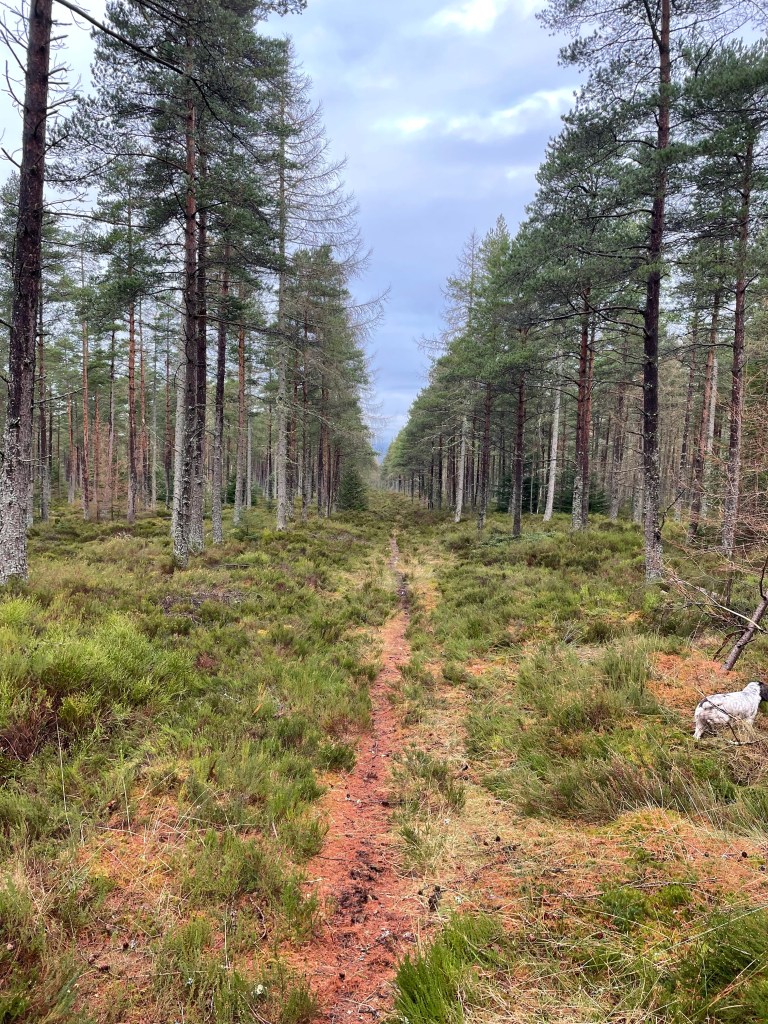
Path to the stone
Return by retracing your steps back to the carpark. There is a circuit but due to recent storms I decided that it was best not to carry on in case of falling trees.
When you think of going to Cullen for a walk you usually think of the stunning beach of The Three Kings. But just a couple miles out of Cullen is the lovely wee hill called the Bin of Cullen a little bit different from a beach walk but still very enjoyable!
There is a maze of paths and tracks all over the Bin, this route takes you to the summit of the Bin of Cullen with fantastic views of Cullen, Buckie and right along the coastline to Spey Bay. On a very clear day the hills of the Black Isle can be seen clearly in the distance. It is a very family friendly hill that is lovely all year round.
Distance: 3.5 miles Time: 1.5-2 hours Level: Easy with some elevation Terrain: Well-trodden forestry track. The path is suitable for an off-road buggy. Access: Arrive by car. To reach the start of the walk from Cullen follow the B9018 towards Deskford for around 2 miles then turn right up the road marked Hill of Maud. Just over a mile along the road on the right-hand side you will see a gated entrance marked Seafield Estate. What3words : ///madder.focal.clipboard
There is parking for several cars just at the entrance of the walk, please be mindful when parking not to block the gate.
Track at the start of the walk
Route: Once parked go round the gate and follow the main forestry track, it does go downhill initially.Ignore the track to the right. After a short distance you will come to a small bridge over the Glen Burn. Once over the bridge there is a junction, take the track to the left which leads you through the Scots pine plantation.
The track will gradually ascend. Keep a look out for the rope swing to your right, a great place to stop for kids but I am sure some adults will not be able resist a go too.
Small bridge over burn
After the rope swing further up the track there is another junction. Take a left here. Keep on this track ignoring the one to the right a little bit further on. As you reach the summit there are several narrow rough tracks, avoid them as theyare used by mountain bikers descending the summit.
Wild flower
Keep your eyes peeled for breaks in the trees where you get great views of the surrounding countryside. Once out of the trees the track continues zigzagging till you reach the summit with a carpet of heather at each side. When the top is reached and you find the cairn and trig point it is time to enjoy the fabulous coastal views. There is enough room at the summit if you want to have a picnic or to just sit, enjoy the views and take some photos.
View of the coast
The return route is simply retracing your steps.You will get another chance to enjoy the walk in the woods. Keep a look out for pine marten, red squirrel and crossbills. I wasn’t lucky enough to see any furry friends,. There is also an abundance of wild flowers and fungi which I did manage to photograph. As the seasons change there is always something new to spot.
This is a fantastic short walk for all the family only a few miles out of Elgin. It is beautiful no matter what season it is.
Distance: 1 1/2miles Time: 1hr Level: Easy with a little elevation Terrain: Woodland paths can be a little muddy and uneven. Some steps Access: Arrive by car, Millbuies Country Park is situated in the village of Fogwatt around 6 miles from Elgin. Postcode is IV30 8FW. There is a good size carpark.
Route: Leaving the carpark head for the Millbuies sign passing by the house and you come to the large stone cairn.
Cairn at Entrance
Follow the path till you reach the loch. We went straight on here passing the boats then the wooded hide. There is footbridge a 1/3 of the way down the loch.
Walk way over the loch
Keep your eyes peeled for ducks on the loch. Further on there is a path your left that takes you up to higher ground and rejoins the path you are on further on. I like to stick to the lower ground beside the loch.
Ducks on the loch
When you reach the end of the loch loop back by going over the footbridge and up the steps.
View at the end of the loch
Return by walking along this side to you come back to the start.
Don’t forget to visit Willow & Birch for coffee and cake after!
Great circular walks are sometimes not so easy to access if you are using public transport so after a wee bit of research, I found this cracker that takes in so many interesting, historical, beautiful places within a relatively small area.
Distance: 4 miles Time: 2 hrs Level: Easy with some elevation Terrain: Pavements and woodland tracks Access: Arrive by car parking is available at Grant Park IN36 1BG. There is a regular No10 Stagecoach bus that runs between Aberdeen and Inverness with a bus stop nearby. Forres also has a regular train between Aberdeen and Inverness, the station is a short walk from the start.
Route : Arriving at Grant Park there is a spacious car park with toilets which is always a bonus. Start the walk just at the information board where you will find a map of the various walks in the area. As you leave the car park via the main opening turn right and head along the street.
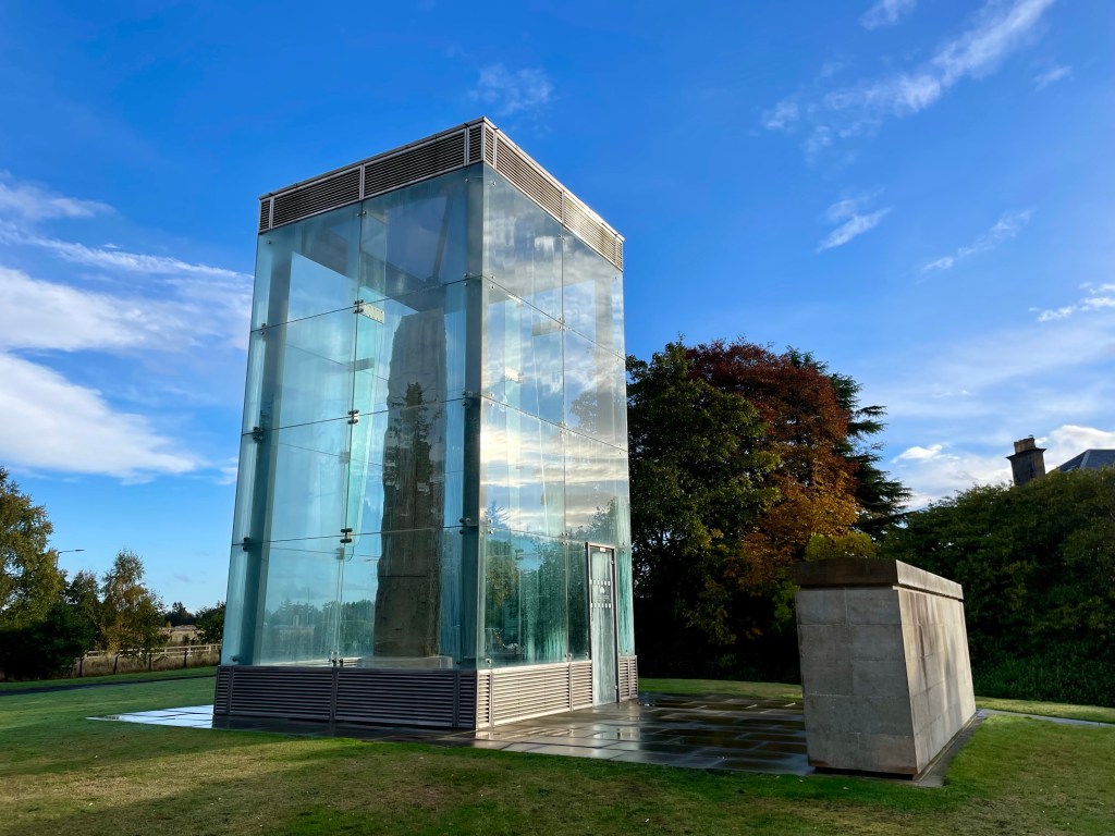
Sueno’s Stone
After a short distance you will see the signs for the Sueno’s stone. Cross the road here and go straight on towards the stone. Sueno’s stone stands at an impressive seven metres tall and thought to be carved around mid 800s AD and early 900s AD. The stone has a fantastic information board where you can find out more.
Leaving the stone head back then turn right on to Croft Road. You will start to find the waymark posts which will guide you along the way. Before Croft road curves to left you will see your next waymark that takes you along a track to the right and through a gate. Careful here as you will have to cross the main road.
Carved owl
Once you cross the road you will find a track that takes you along past the railway line, here you will find some fantastic carved wooden sculptures make sure you spot them all. When Benromach distillery comes into view on your right, you will turn left and cross back over the main road but there is a wee island here in case the road is busy.
Mosset Pond
Here the marker post will take you along past the Mosset pond, which is beautiful and full of paddling ducks. Once you come to the end of the pond, cross the road and take the road to the right and head towards the war memorial. There is a nice path that runs alongside the Burn of Mosset.
Sanquhar waterfall
At the Orchard Road cross over the bridge and carry on along the path next to the burn. The road will turn right along past Forres Academy. Just after the academy take a right turn and carry on till you get to Sanquhar Loch, here you will find the beautiful waterfall.
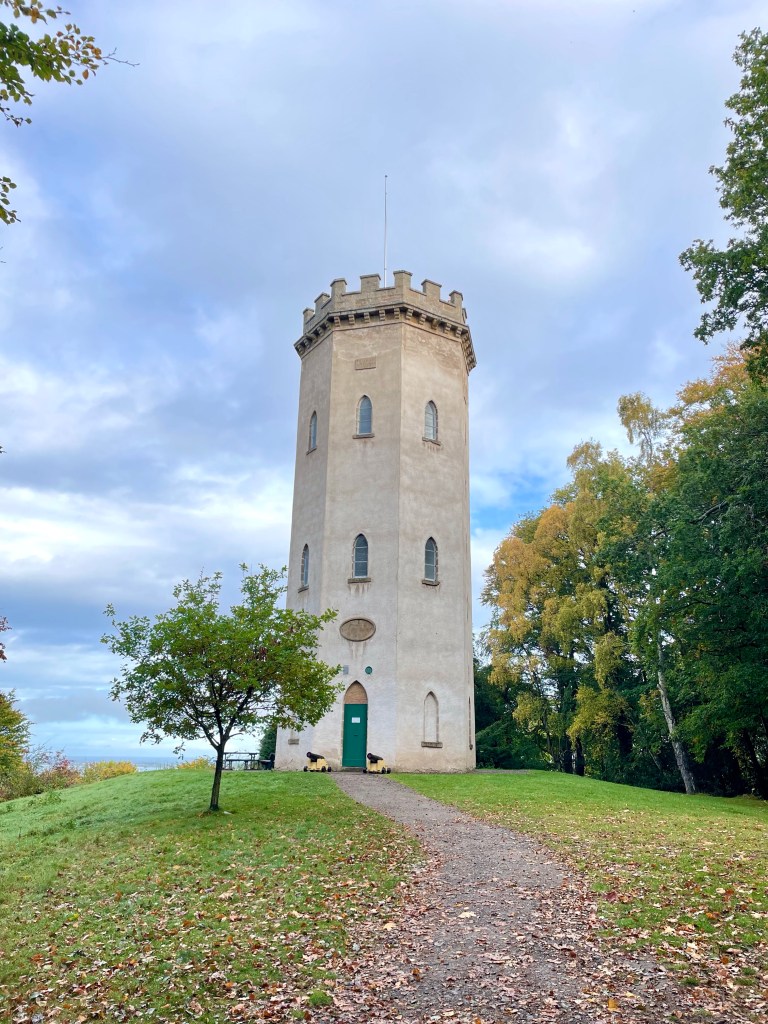
Take the path to the left of the waterfall which takes you on a peaceful stroll through the woods. Once out of the woods, cross over the road and on to the road opposite. This road is very well marked for Nelson’s tower. Once you skirt past the cemetery the path will climb up and will shortly reach the magnificent tower.
Nelson’s Tower
Nelson’s Tower was erected by public subscription. The foundation stone was laid in 1806 by James Brodie of Brodie and was completed in 1810. It is open in the summer months, and you climb to the top and admire the beautiful coastal views over Findhorn.
Grant Park gardens
Once you have enjoyed the views and explored the tower area. Return on the same path till you come to the fork, take the right fork down towards Grant Park. You are only a short distance from where you started but before returning make sure you explore the beautiful gardens, and you could even venture up the High Street and check out the fantastic range of independent shops and cafes that Forres has to offer.
This is a stunning walk with epic views of the Cairngorm’s. Great walk if you want just a wee hill to climb rather than a munro!
Distance: Around 3.75 miles Time: 1 1/2-2hrs Level: Easy with some steep sections Terrain: Well maintained path, tar, grass track and woodland track. Access: Arrive by car parking at the entrance to Dalraddy campsite PH22 1QB.
Route: Starting in the carpark go to your left through the quad bike area and head under the railway bridge. Take a left after the bridge and head through the gate. Keep going till you reach the junction take a right here and head along the tarred road.
You will reach a fork in the road take the left hand track. Go up the track till you reach the gate and the grass park. Follow the path to the left edge of the park till you reach the opening on your left and the track that takes you in to the woods.
Looking back at the opening
Follow the track till you reach the fork. Take the left fork here and continue straight on. Keep a look out for the Waterloo cairn to your right that is worth stopping at. The cairn was erected by Marquis of Huntly, August 11, 1815 in memory of Robert Macara of 42nd Royal Highlanders, also Of Col. John Cameron of 92nd or Gordon Highlanders and their brave countrymen who glorious fell at the battle of Waterloo June 1815.
The Waterloo Cairn
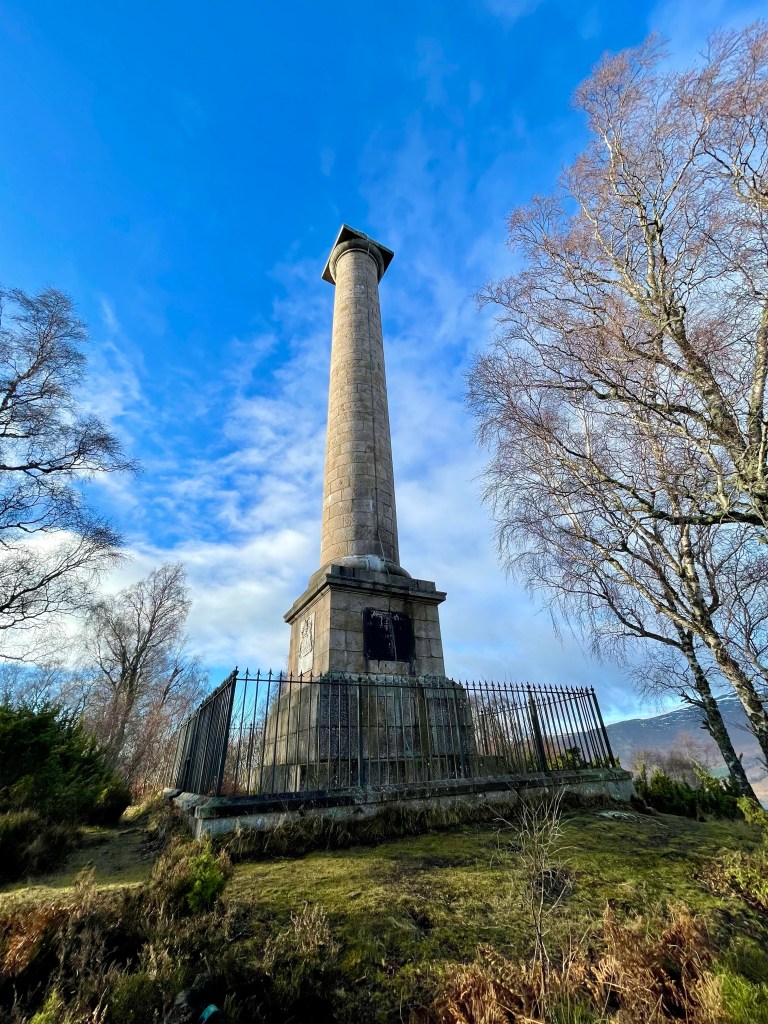
Not long after the Waterloo cairn the monument will come in to view. The track does go down hill a little before climbing back up.
The Duke of Gordon Monument
The track winds its way through the trees till you come to the Duke of Gordon Monument that commemorates the last Duke of Gordon who died in 1836. Once you have explored the area you return the way you came taking in the beautiful views.
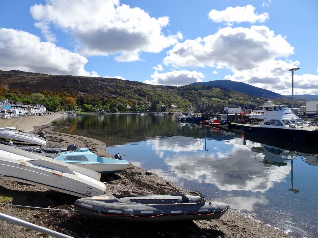
I ventured a wee bit further afield for a change, to Ullapool which we visit on a regular basis. Ullapool is on the North Coast 500 route and is one of the larger towns in North West Scotland with a busy ferry port and harbour. There is a great selection of places to eat and stay. Overlooking Ullapool is a hill called Cnoc na Croiche also known as Ullapool Hill which is a short but steep climb with very rewarding views.
Distance: 2.25 miles Time: 1hr Level: Easy with some steep parts. Terrain: Mix of pavements, well walked paths and uneven paths. Access: Arrive by car, parking is available in the long stay car park beside Tesco IV26 2XB. There is a regular stagecoach bus from 42 Inverness
Route: I am starting my route from the harbour on Shore Street in the centre of Ullapool. Cross the road at the boat trip and bike hire cabins and head up Quay Street past the Fish and Chip shop, try and resist the smell that is guaranteed to make you hungry. Take the third road on the right called Market Street and follow it to the end, before turning left and heading up Mill Road.
Ullapool harbour
On your right, just after you have passed Highland Stoneware and Broom Court, you will see a gate and a signpost for Ullapool Hill. Go through the gate and you will start the short steep climb, but there are plenty of benches to stop and catch your breath. You will pass a path to your right, ignore it, but not long after you will take a turn to the left and you will head further up the hill.
Path on Ullapool hill
You will come to a bench with a path on the left and one behind, take the path behind the bench. The path becomes rougher so watch your step. You will see a pile of stones to the right but keep going along the path till you reach a slightly overgrown viewpoint stone, although the views are great here they are better further along the route.
Just past the pile of stones that is to your left, the path will become rougher again and you will need to watch your step to get you down to the bench, where in my opinion you get the best views of Ullapool and Lochbroom.
View of Ullapool
If it isn’t windy this is also a great spot to stop for a snack and wee rest before you head back down the hill. If you time it right with the ferry times, you may see it coming in or leaving, or if you are really lucky, you may even see one of the cruise ships that visit Ullapool.
You will see a rough path to the right, take it and it very soon returns you to the bench before the viewpoint. Take a left here and head back down the path.
Take the path on the left just beside the viewpoint, this will take you to the best view.
Keep going back down the track, a little after the left turn in the path you will see an opening that takes you down to a wooden bridge. Once over the footbridge you carry on descending till houses come into view and you come to a gate. Once through the gate follow the road and you will quickly find yourself at the back of The Royal Hotel on Shore Street.
Ullapool harbour
I would recommend crossing the road here to admire the boats in the harbour. It is a great chance to get some more lovely photos before returning to your starting point and time for a well-earned Fish and Chips.