
Distance: 3 miles Time: 1 – 1.5 hrs Terrain: All pavement Difficulty: Easy, with some elevation. This route is accessible for most walkers. There are no steps or step avoidance detours needed. Getting there: There is plenty of parking at the start of the walk in Reidhaven Square (AB55 5AB). The Stagecoach No. 10 and Ember buses also stop in the Square; both run services between Aberdeen and Inverness.
This is a beautiful walk in my home town of Keith, a place steeped in history. In 2014, Keith was proudly named Scotland’s first Scots Toun for its efforts in celebrating and promoting the Scots language and culture, particularly the local Doric dialect.
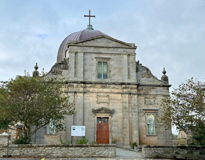
Begin in Reidhaven Square and head up Chapel Street towards St Thomas’s Catholic Church, a striking landmark in the centre of Keith with its distinctive copper dome.
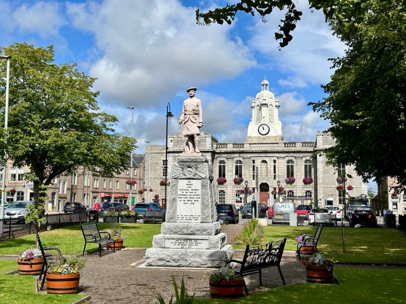
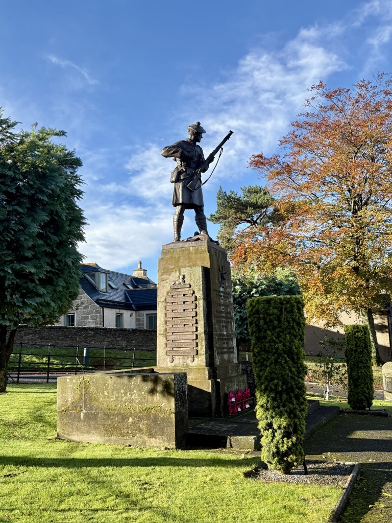
Once you have visited the church, head back down to Land Street and turn left, continuing until you reach the war memorial at the foot of the street. The beautifully maintained memorial garden contains three monuments: one for WWI, one for WWII, and one for those who died outwith the wars.
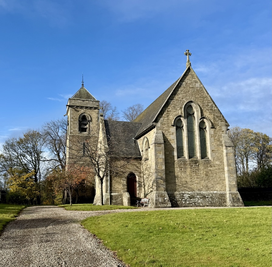
From here, turn left and pass the Ugie House Hotel. You will soon come to the Keith Band-stand, and just across the road stands the very grand St Rufus Church. Designed by James Gillespie Graham, St Rufus was built in 1816 to replace a medieval church that once stood in the old cemetery near the River Isla.
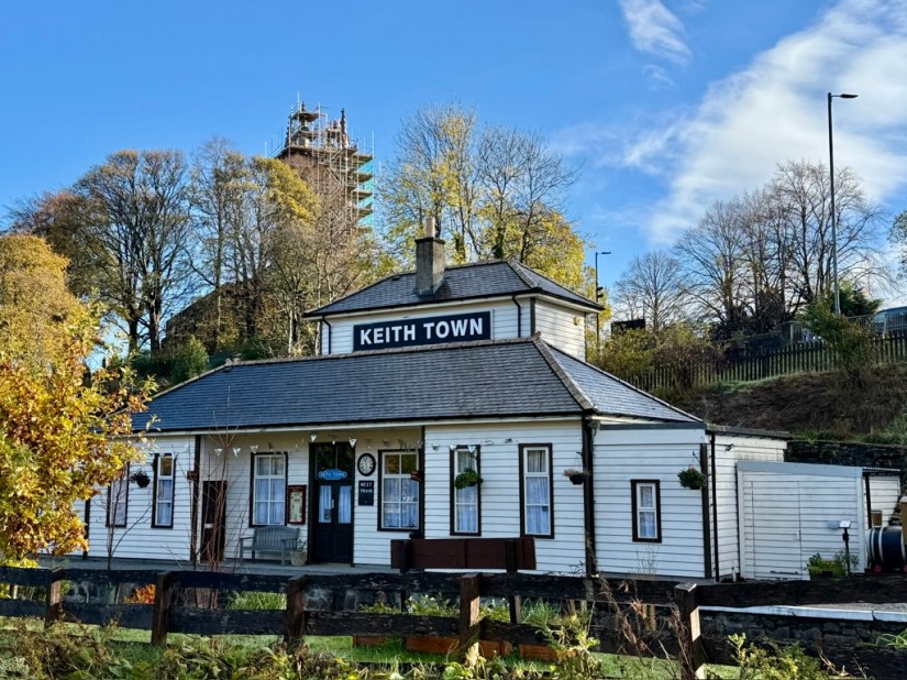
Continue down the road towards Bargain Buys, which stands on the site of the old mart. Across the road is Keith Town Railway Station, where trains run between Keith and Dufftown on the Whisky Line during the summer months, along with special services throughout the year.
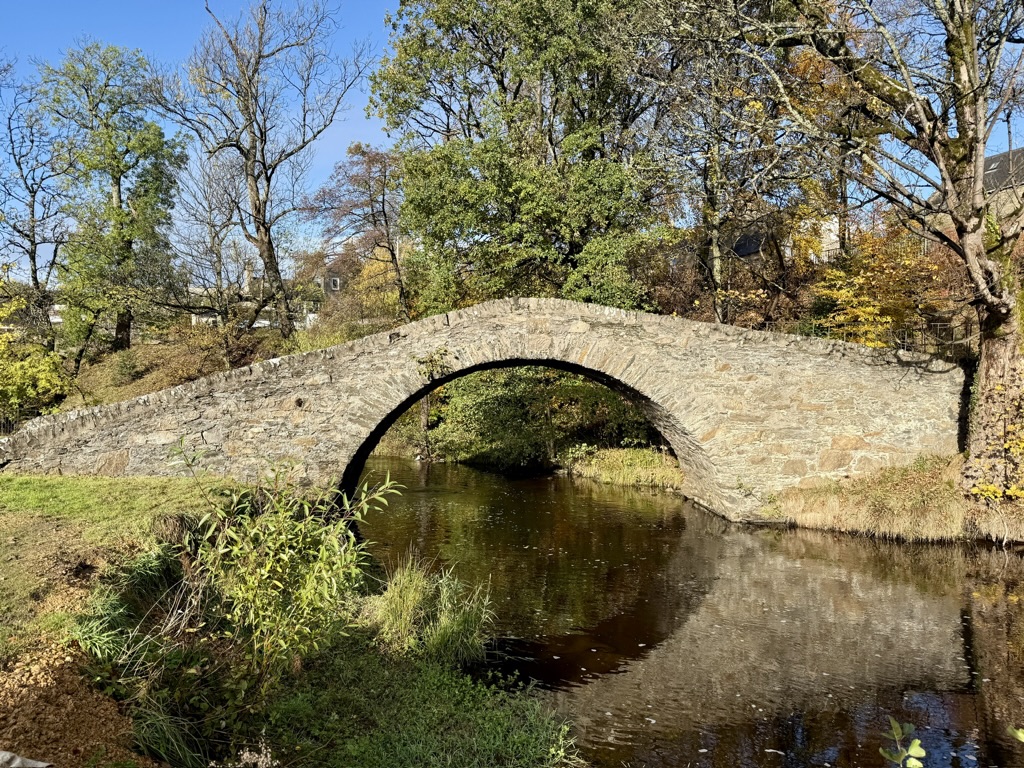
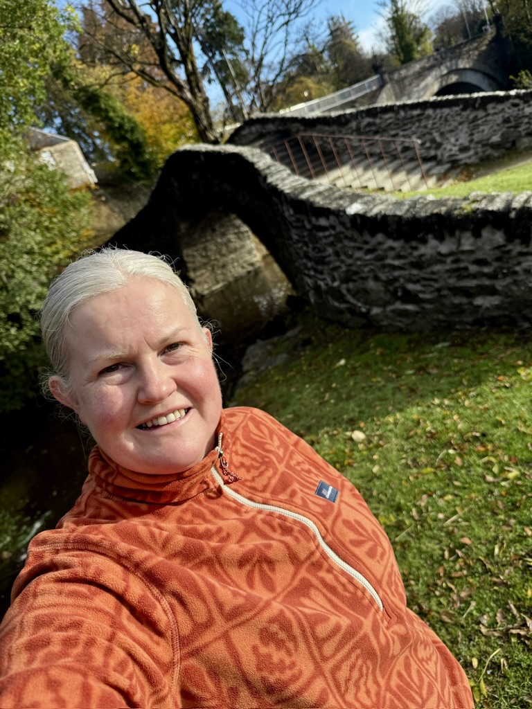
Just after Bargain Buys, there is an opening on your left leading down to the Auld Brig. The bridge was built in 1609 by Thomas Murray and his wife, and it is said to have been erected in memory of their son, who drowned while crossing the ford.
To the left of the bridge, you can see a large stone covering a small opening. This is known as Campbell’s Hole. According to local stories, this is where the Hanoverian Campbells hid from the Jacobites after a battle in 1746.
From the bridge, you can take the steps back up to the street or retrace your steps to Bargain Buys. From here, head over the Union Bridge, where the River Isla flows beneath. You are now in Fife Keith.
Continue up the road until you reach the traffic lights. This is a safe crossing point. Cross the road, turn left, and then take the road on your right just after the Beauty Box.
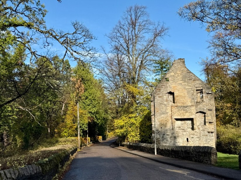
Walk down Station Road, passing Glen Keith Distillery on your left. As you cross back over the Isla you will see the rear of Strathisla
Distillery. In front of you stands Milton Tower, the only surviving part of Milton Castle. Built around 1480 by George Ogilvie, the castle fell into ruin by 1715, and only the north portion, now known as Milton Tower, remains.
Continue along the road until you reach the bridge over the old railway line. Take a right here, cross over the railway line, and head straight up Seafield Avenue. You will pass Strathisla Distillery, the oldest continuously operating distillery in the area, dating back to 1786.
After Strathisla, you will reach St Rufus Park and the tennis courts. Across the road stands Holy Trinity Church, where my husband and I were married. Just after the tennis courts, take the track to the left. On your right you will find three very large stones erected in 2007 by the Keith and District Heritage Group. Each carries a plaque listing notable people from Keith and Strathisla.
Continue along the track to Scotscraig Gardens, where you will find yourself back at the war memorial. Turn left here, passing the bowling green and Longmore Community Hall.
Cross Banff Road, then take a right crossing at the traffic island.
You are now at the bottom of Mid Street, next to the North Church. Head up Mid Street, where you will find a fantastic selection of independent shops to explore before returning to Reidhaven Square, where your walk began.
This is only a small snapshot of Keith. There is so much more to discover.