
Tag: new experience

Delgatie Castle and Woods
Distance: 2 ¾ miles Time – 1 ½ hrs Time: 1.5-2 hours Level: Easy with a little elevation Terrain: Well walked forestry paths can be a little wet under foot in places. Access: Arrive by car. To reach the start of the walk from Turriff take the A947 towards Banff.
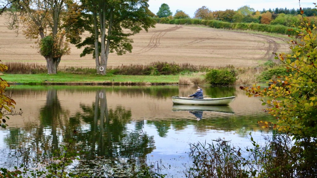
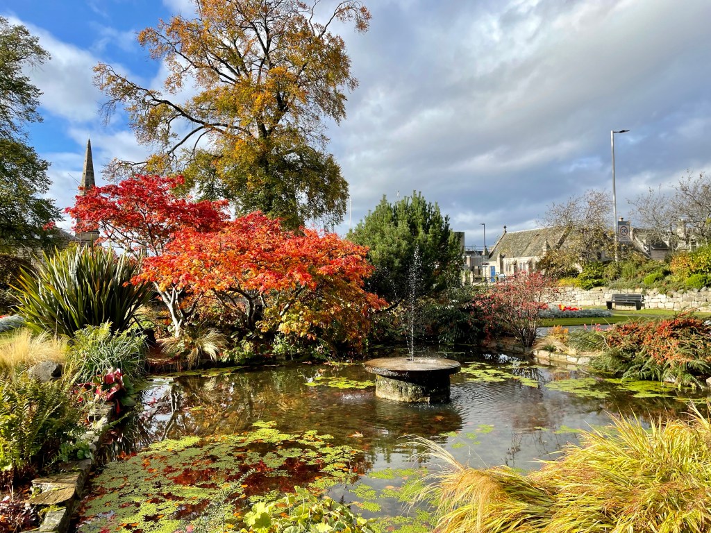
Approx 1 mile along the road there is a sign post for Delgatie Castle to the left take this road for approx 1 ½ miles.The Castle is well sign-posted and can be seen from the road on the right. You will turn into the entrance to where the Castle is sign posted and there is ample parking and a forestry information board. Delgatie Castle and Woods is a stunning walk that takes in not only a walk in the woods, you also go past Delgatie trout fishing pond where you can see ducks and swans, then round the grounds of the stunning Castle that dates back to 1030. What is visible today is from around 1570 with later wings added in 1743.
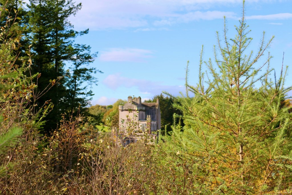
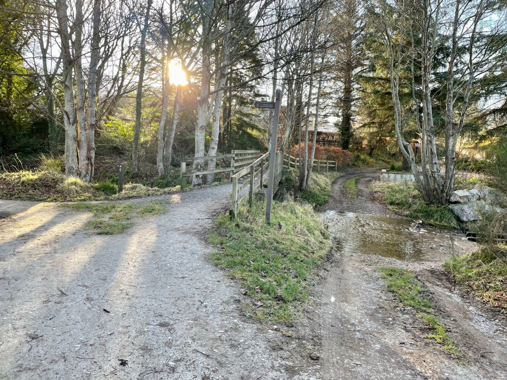
Route: From the car park you will see some steps at the left, head up the steps following the red way markers. Just after the steps there is a path to the right that is worth a detour where you will find the hidden ice house which would have been used to store perishable foods in bygone years. Back on the main path there is another detour to the right, a great opportunity to get your camera out as there is a great view of the Castle. On the main path again continue straight uphill and into the woods. The path will take a right then a left, keep following the main route with the marker posts.
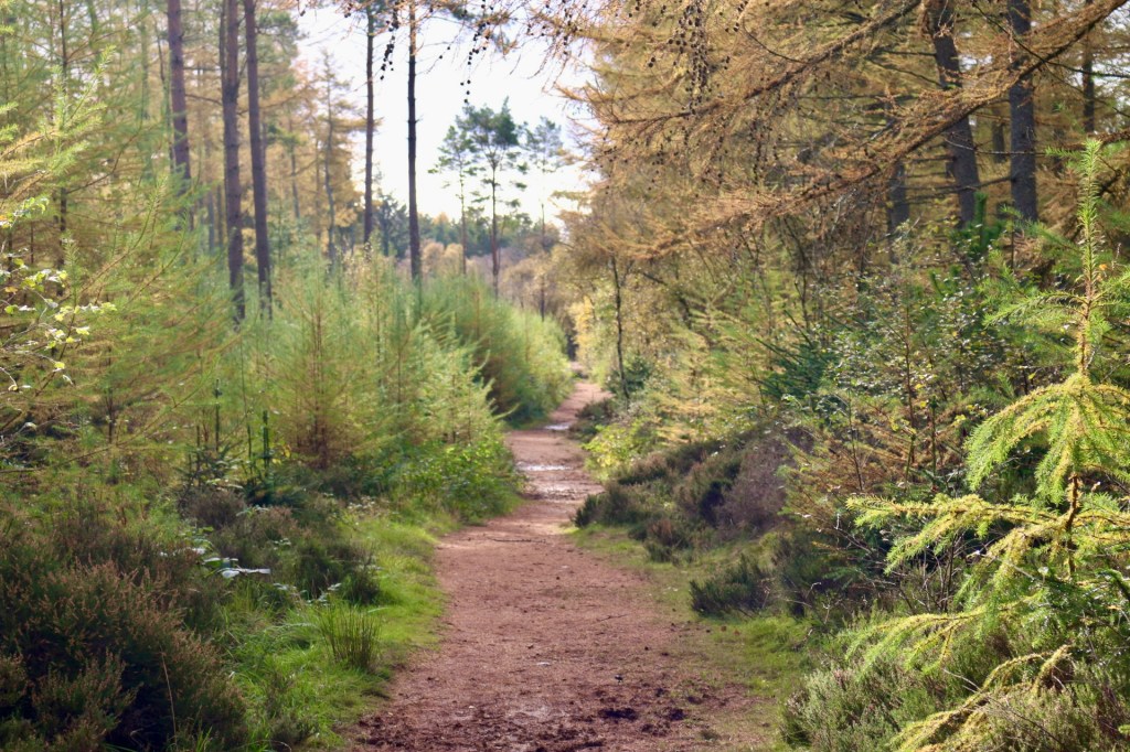
The path will curve to the right again and you will come to a junction, you take a left here following the blue marker post. Keep your eyes peeled for red squirrels, along with plenty of other wildlife, while you are walking throughout the woods. I was lucky to see a large bird, possibly a buzzard as I left in the car. The path carries on through the woods until it will take a right and it will carry on close to the edge of the woods. To your left there will be great views of Bennachie, there is a small detour path where you can take great photos of not only Bennachie but if you look to your right, Ben Rinnes is also visible. The path eventually reaches a car park to the left, continue downhill until you reach a track, you take a left here on to the road. You will pass by the Fishing pond and keep a look out for ducks and swans on the water. Shortly after you pass the pond you will return to the carpark.
At the carpark you have now an opportunity to walk round the Castle grounds, please be aware no dogs are allowed around this area. If you choose to go round the grounds take a left in the carpark past the Cottage and Dovecot. Head up the stairs, the road takes a loop right round the Castle grounds before you will come over the cattle grid then return back to the carpark.
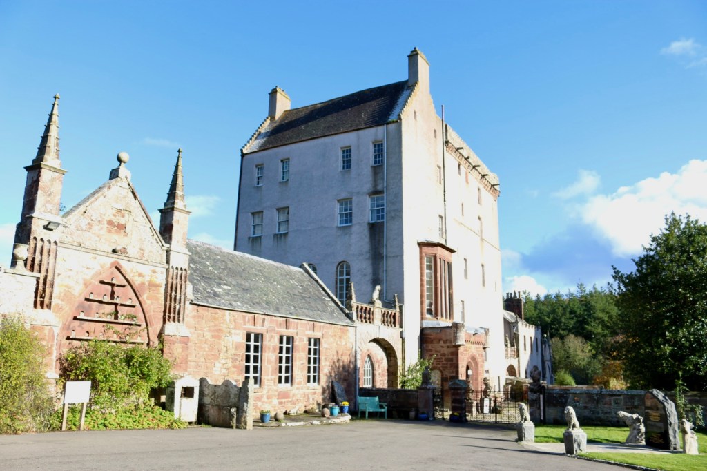
You can extend your visit and take a tour round the Castle and treat yourself to tea and cakes in the Castle’s very own tea room the Laird’s Kitchen. Open 10am – 4pm daily.

The Discovery Trail at Cabrach Trust
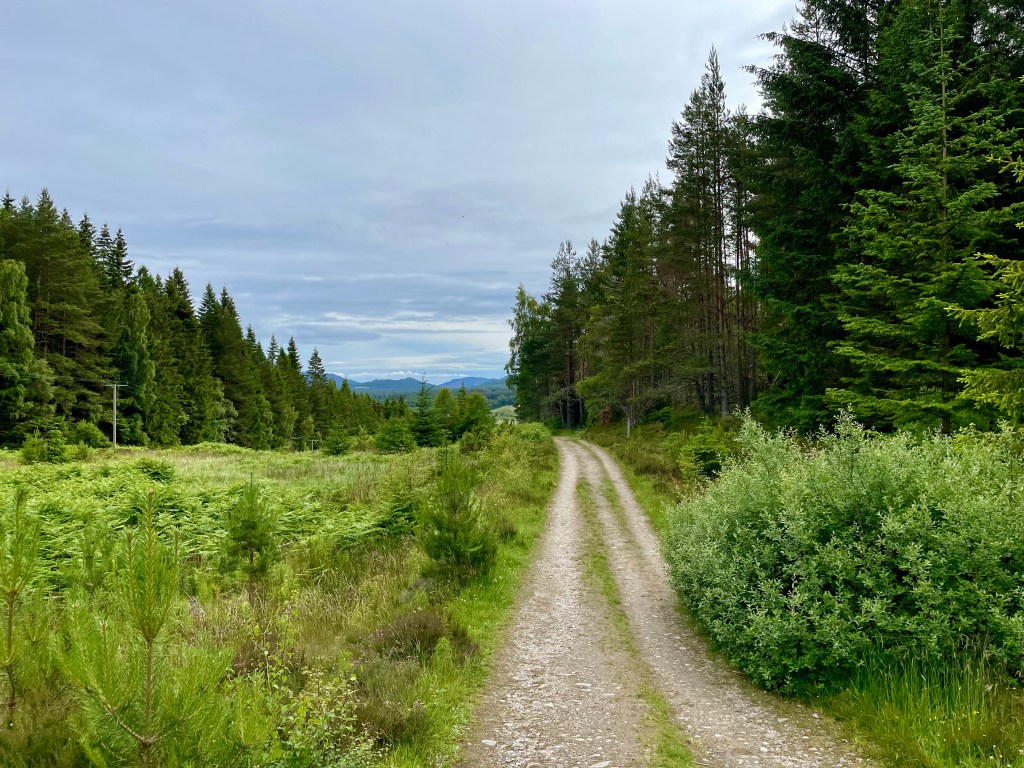
The discovery trail is a fantastic nature trail on Inverharroch Farm that the Cabrach trust purchased in 2013. The beautiful trail opened in 2022 and sits on the edge of the Deveron and Blackwater Rivers.
Distance: 2kmTime: 45mins Level: Easy Terrain: Well kept path Access: Parking is available at the Acorn Centre. It is easy to find coming from Dufftown or Rhynie at Lower Cabrach, Cabrach AB54 4EU
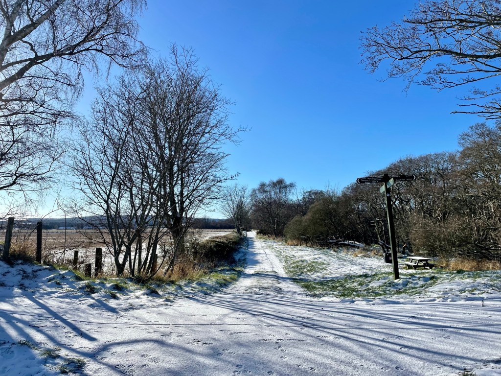
Leaving the carpark go past the information board and head towards the the small renovated building and turn left here you will join the discovery trail.

It is an amazing path that is buggy friendly that will take you along to the pond first that you can walk all the way round. Before heading along to the bird hide. That just sits on the edge of the river.

Remember to look up and down as we spotted a stoat, buzzards and hares. Keep along the path and you will find a lovely picnic area before you come to the Blackwater bridge.
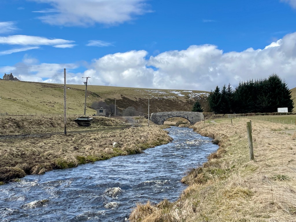
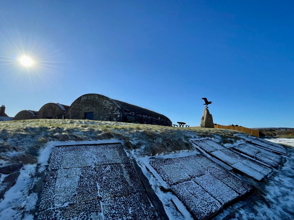
From the Blackwater bridge we turned right and went through the gate on the right to head up to the bunker on the hill. You also get a great view of the distillery there too!

To return you just retrace your steps and back to the carpark.

Speybay – River Spey Viaduct Circuit
Distance: 2 miles Time: 1 hr Level: Easy Terrain: Good path, pavement and road Access: Arrive by car there is plenty of parking at the Speybay dolphin centre IV32 7PJ (donations for parking)
This is a fab short circuit walk from Speybay via the Spey viaduct. The walk is all on the flat with a good path so family and buggy friendly!
Route: From the car park head for the information board and you will see the path to the left that runs along the side of the river. Head along the path over the wooded footbridge and keep going!

You will follow this path all the way along till you come a 4 way junction. Take the road to the right just before the sign to take you along to the banks of the river and to get a great view of the viaduct.
To return back to Speybay. Go back to the junction and take the track that takes you to the main road. When you get to the main road cross the road on the the pavement and take a left back towards Speybay.

Once you are back to Speybay take a left at the Bay golf club and head back to the carpark.

The Intake and Canal Fochabers
This is a beautiful trail that not only takes you along a section of the River Spey it gives you a chance to see the remains of a very interesting hydro scheme that was way ahead of its time dating back to the early 20th century, the initiative came from the Duke of Richmond and Gordon who for some years envisaged his Castle being lit by electricity.

Distance: 2 ¾ miles Time: 1hr Level: Easy low-level walk Terrain: Well walked woodland paths with some tarred and pavement walking. Access: Arrive by car, parking is available at the Speyside Way car park opposite the opening of Gordon Castle at IV32 7EH. There are also good bus links from Stagecoach with a stop near the start of the walk.
Route: At the car park take a left and head towards the memorial gardens where you get an amazing, framed view of the River Spey. To the left you will see some steps, go down them and follow the path along. There is a small opening if you want to get a good view of the fish ladder. Back on the path go over the footbridge at the fish ladder you will see the signpost to the Intake.
Once over the footbridge you will pass some big houses, then there is a fork in the road, take the right fork towards the wooded area. Once on the wood track you will see a wayward marker post, just after you pass it take the opening to the right on the narrower path. This is where you will first see the derelict canal. The path can be quite uneven here and wet but well worth walking and getting dubby boots for.

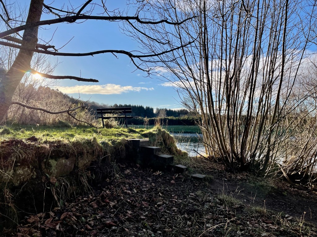
Keep on this path, it will eventually come to the edge of the river where you will get some great views of Ben Aigan in the distance. Follow the path right along the river and you will come to some steps and a bench. This is a great place to stop for a picnic and do some bird spotting on the river.
Just beyond the bench you will see a wee opening and a little overgrown path where you will find an information board and the intake where the water came in to power the scheme. You still see the grid that was put there to keep fish and debris out. The water ran along the lade (known as the ‘Canal’) to the power station to drive the turbines to produce the electricity.
Head back to the bench there is a path at the right that will take you along beside the edge of the canal. Keep your eyes peeled along here as there are several scrap cars buried in the undergrowth in the canal which were dumped many years ago. Keep on the same path it will take you back to the wayward marker post where you turned off.

Once back on to the tarred road, at the fork keep right, when you get to the shed at the end of the road turn right on to West St. Halfway along you will see a waterfall on the Burn of Fochabers and a wooden foot bridge running over it. Go over the bridge then take the next right on to George St. This will take you to Fochabers Square. On the other side of the road opposite the fountain you will see a large streetlamp that commemorates the opening of the scheme. Which is a great way to finish the walk.
From the square you can just go along the High St past the traffic lights and bowling green and you will return to the carpark. There are a few cafes on the High St and a lovely ice-cream shop if you fancy some refreshments after your adventure.


Forres Mosset Walk
Great circular walks are sometimes not so easy to access if you are using public transport so after a wee bit of research, I found this cracker that takes in so many interesting, historical, beautiful places within a relatively small area.
Distance: 4 miles Time: 2 hrs Level: Easy with some elevation Terrain: Pavements and woodland tracks Access: Arrive by car parking is available at Grant Park IN36 1BG. There is a regular No10 Stagecoach bus that runs between Aberdeen and Inverness with a bus stop nearby. Forres also has a regular train between Aberdeen and Inverness, the station is a short walk from the start.
Route : Arriving at Grant Park there is a spacious car park with toilets which is always a bonus. Start the walk just at the information board where you will find a map of the various walks in the area. As you leave the car park via the main opening turn right and head along the street.
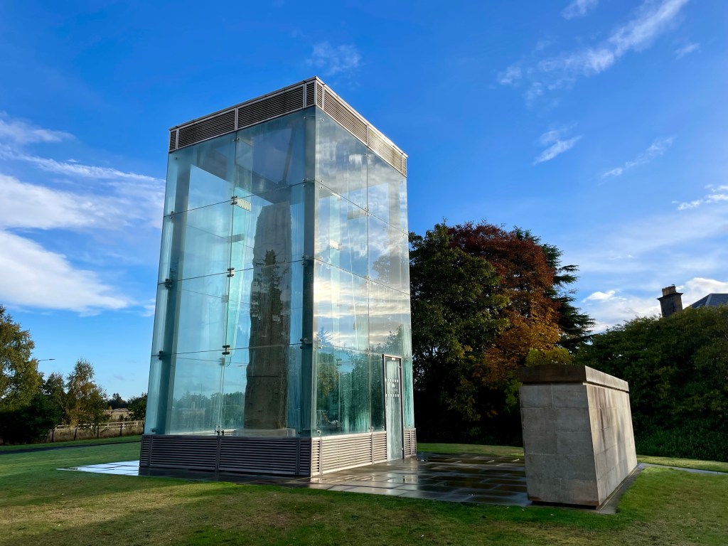
After a short distance you will see the signs for the Sueno’s stone. Cross the road here and go straight on towards the stone. Sueno’s stone stands at an impressive seven metres tall and thought to be carved around mid 800s AD and early 900s AD. The stone has a fantastic information board where you can find out more.
Leaving the stone head back then turn right on to Croft Road. You will start to find the waymark posts which will guide you along the way. Before Croft road curves to left you will see your next waymark that takes you along a track to the right and through a gate. Careful here as you will have to cross the main road.

Once you cross the road you will find a track that takes you along past the railway line, here you will find some fantastic carved wooden sculptures make sure you spot them all. When Benromach distillery comes into view on your right, you will turn left and cross back over the main road but there is a wee island here in case the road is busy.

Here the marker post will take you along past the Mosset pond, which is beautiful and full of paddling ducks. Once you come to the end of the pond, cross the road and take the road to the right and head towards the war memorial. There is a nice path that runs alongside the Burn of Mosset.

At the Orchard Road cross over the bridge and carry on along the path next to the burn. The road will turn right along past Forres Academy. Just after the academy take a right turn and carry on till you get to Sanquhar Loch, here you will find the beautiful waterfall.
Take the path to the left of the waterfall which takes you on a peaceful stroll through the woods. Once out of the woods, cross over the road and on to the road opposite. This road is very well marked for Nelson’s tower. Once you skirt past the cemetery the path will climb up and will shortly reach the magnificent tower.
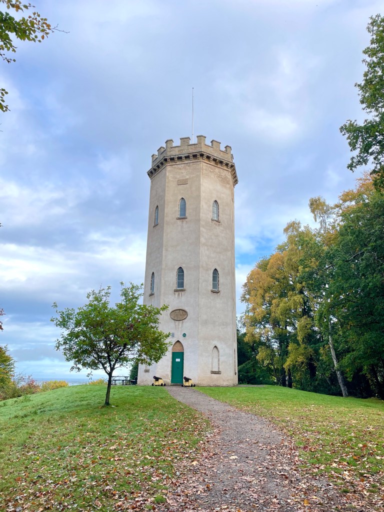
Nelson’s Tower was erected by public subscription. The foundation stone was laid in 1806 by James Brodie of Brodie and was completed in 1810. It is open in the summer months, and you climb to the top and admire the beautiful coastal views over Findhorn.
Once you have enjoyed the views and explored the tower area. Return on the same path till you come to the fork, take the right fork down towards Grant Park. You are only a short distance from where you started but before returning make sure you explore the beautiful gardens, and you could even venture up the High Street and check out the fantastic range of independent shops and cafes that Forres has to offer.

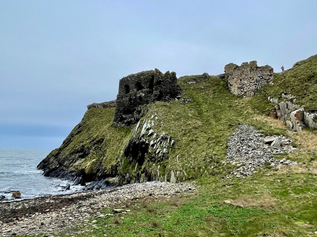
Walk to Findlater Castle
Findlater is a ruined castle in Aberdeenshire and only a couple miles from Cullen. It is the old seat of the Earls of Findlater and Seafield, sitting on a 50 foot-high cliff overlooking the Moray Firth.
Distance: 1 mile Time: 1hr Level: Easy but may be more difficult if the path is muddy some elevation. Terrain: Grass track and narrow possibly muddy path. Access: Arrive by car heading east from Cullen on the A98 turn left up road sign posted to Findlater Castle. The road takes a sharp corner to the right then take the next left after the first house. Take a left at the house and there is parking round the back of the large barns. Postcode is AB45 2UD. Please keep dogs on leads at all time.
Route: Once parked take the track to the right past the back of the barns. The track will turn left, keep going till you come to the junction.
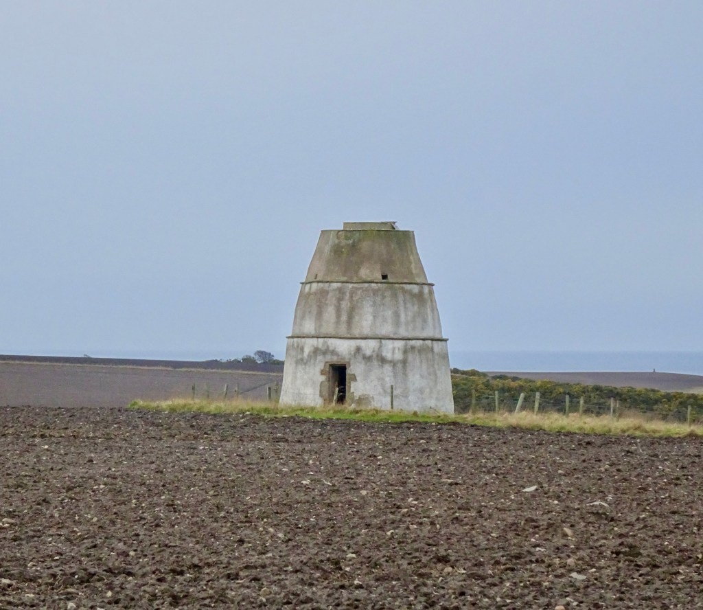
You can take a left at the junction to head along to the Findlater Doocot or head straight on to the Castle.
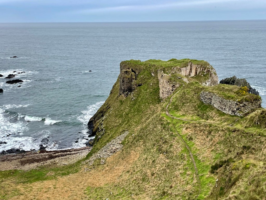
There is a fab viewing area which if you don’t want to go any further you can get a great view and some cracking photos.
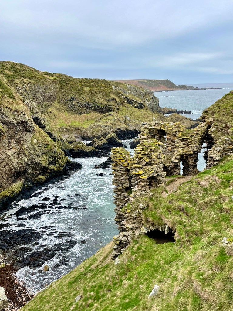
Carefully take the path down to watching where you walk and explore the area.

Why don’t you finish off with a visit to the stoney beach to the side for the full Findlater experience.

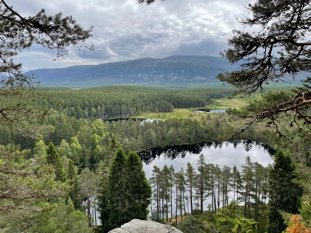
Loch Insh, Uath Lochan’s and River Feshie circuit
I headed to the beautiful Cairngorms for this walk which takes in Loch Insh, the stunning Uath Lochan’s and the River Feshie. This is a very peaceful walk in the wilderness with plenty of opportunities for wildlife spotting. I had several sightings of birds of prey along the way.
Distance: 7 ¾ miles Time: 3 ½ – 4hrs Level: Easy long walk with some elevation. Terrain: Mix of forestry track and paths with a small amount of quiet road walking. Access: Arrive by car following the signposts for Kincraig/Loch Insh outdoor adventure centre PH21 1NU. I did ask permission to park at the centre. There is a regular Stagecoach No 35 bus from Aviemore which is about a 20min walk from the Outdoor centre.

Route: The walk starts off at the Loch Insh Outdoor Centre which is a fantastic facility offering a large array of activities as well as accommodation.
In the car park head down to the shore and you will see a sign for the Loch side trail which is part of the Badenoch way. This is a very well waymarked and easy to follow section with great views across the Loch and the first opportunity for wildlife spotting.

Leaving the waterside carry on following the waymarkers through the woods till you come to a road with a house opposite. Cross the road here and turn right just after the house you will find an opening to re-join the path. The path is rather narrow here but only for a short time.
Keep on the waymarked trail and you will come to a fork and take the path to the left here. There is a long straight section, the Badenoch way turns off here to the right this is where you leave the way as you will carry straight on. About 250 yards after the Badenoch way turns off , you will take a left turn where you will find red trail markers.

Here you will head up in to Farleeitter Crag where you will find a fantastic view of Loch Insh before you are looking down on the Uath Lochan’s once you have enjoyed the views the trail will start going downhill till you come to a junction take a left here after a short walk you will come to another junction where you will take a right to take you to the Lochan’s. This is a fantastic place to stop for a picnic with stunning views.
Carry on the trail before taking the next left, you come to a road. Take a right and walk along the road for a short stretch till you come to an opening to a house road end. Go into the opening and turn to your left you will find a right of way sign. Follow the sign passing by the houses. You will come to a U-shaped house, take the path to the right here. Carry on till you come to the side of the River Feshie. As you walk along the path and you will feel like you are in total wilderness with only the wildlife for company. There are plenty of opportunities if you want to dip your feet in the beautiful clear waters.

Keep following the path right along the riverside till you come to some houses then Feshie bridge on your right. You will find a path just along from the bridge to the right of the road.

Follow the path along till you reach a small car park which then leads you to the Frank Bruce Sculpture Trail which is starting to be reclaimed by nature as it was meant. The trail is worth the detour or take the path to the right which you will find is waymarked for the East Highland way. Follow the waymarkers you will come to a farm, the path will take a left before reaching a junction.

At the junction take a right joining the Badenoch way again which you will follow till you return to the Loch Insh Outdoor Centre. Which is now a perfect time for coffee and cake at the Boathouse Bar and a well-earned rest!
