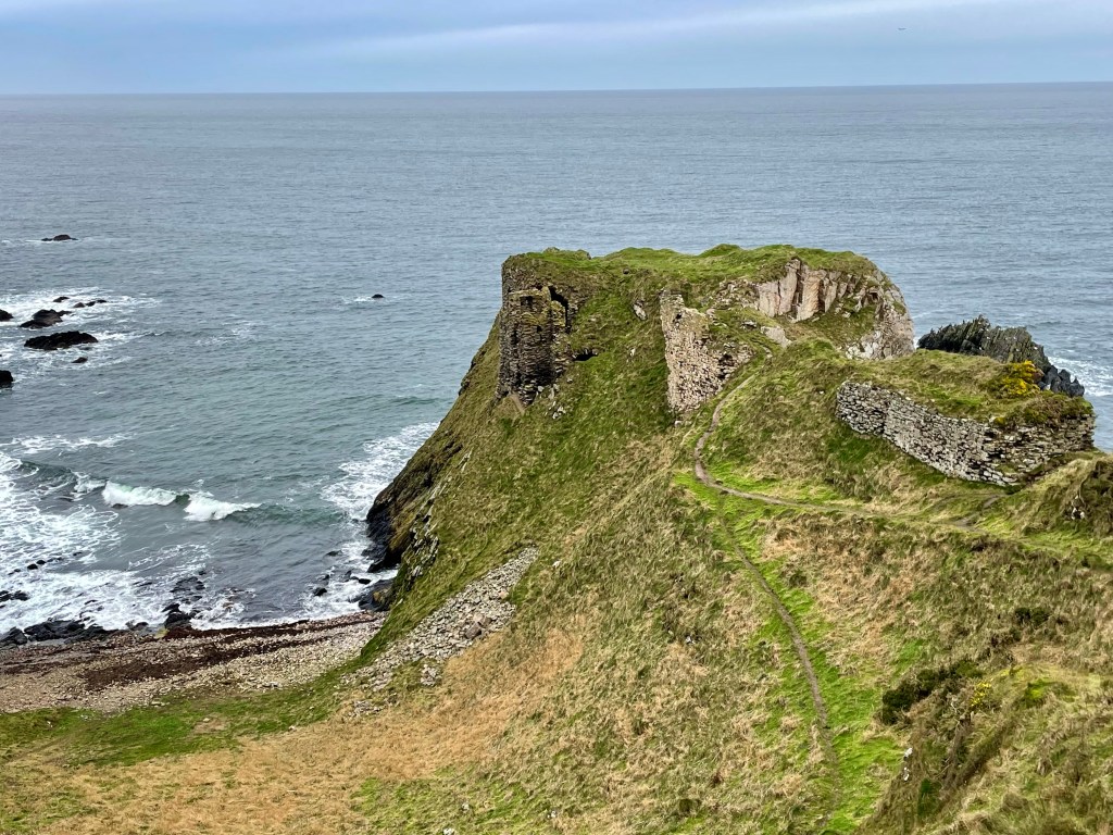
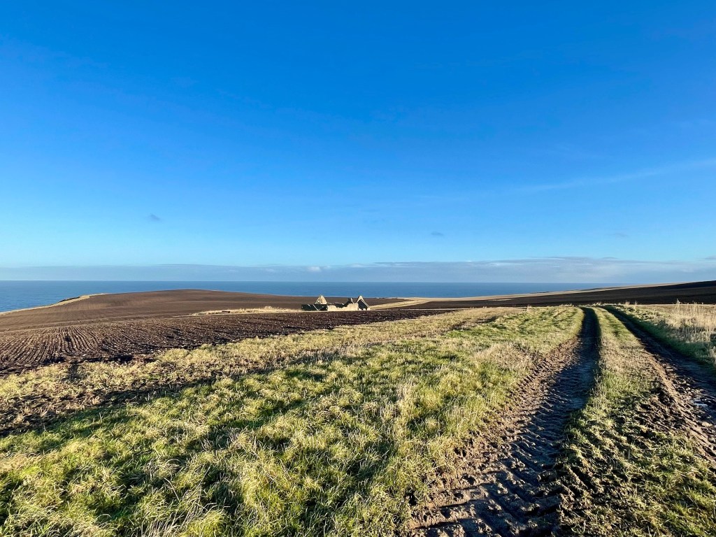
Findlater is a ruined castle in Aberdeenshire and only a couple miles from Cullen. It is the old seat of the Earls of Findlater and Seafield, sitting on a 50 foot-high cliff overlooking the Moray Firth.
Distance: 1 mile Time: 1hr Level: Easy but may be more difficult if the path is muddy some elevation. Terrain: Grass track and narrow possibly muddy path. Access: Arrive by car heading east from Cullen on the A98 turn left up road sign posted to Findlater Castle. The road takes a sharp corner to the right then take the next left after the first house. Take a left at the house and there is parking round the back of the large barns. Postcode is AB45 2UD. Please keep dogs on leads at all time.
Route: Once parked take the track to the right past the back of the barns. The track will turn left, keep going till you come to the junction.
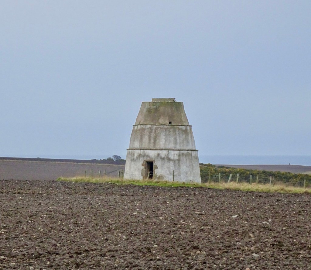
Findlater Doocot
You can take a left at the junction to head along to the Findlater Doocot or head straight on to the Castle.
Findlater Castle from view point
There is a fab viewing area which if you don’t want to go any further you can get a great view and some cracking photos.
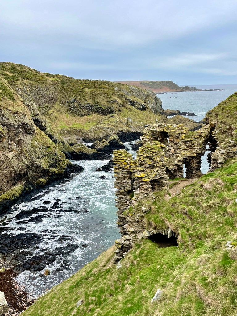
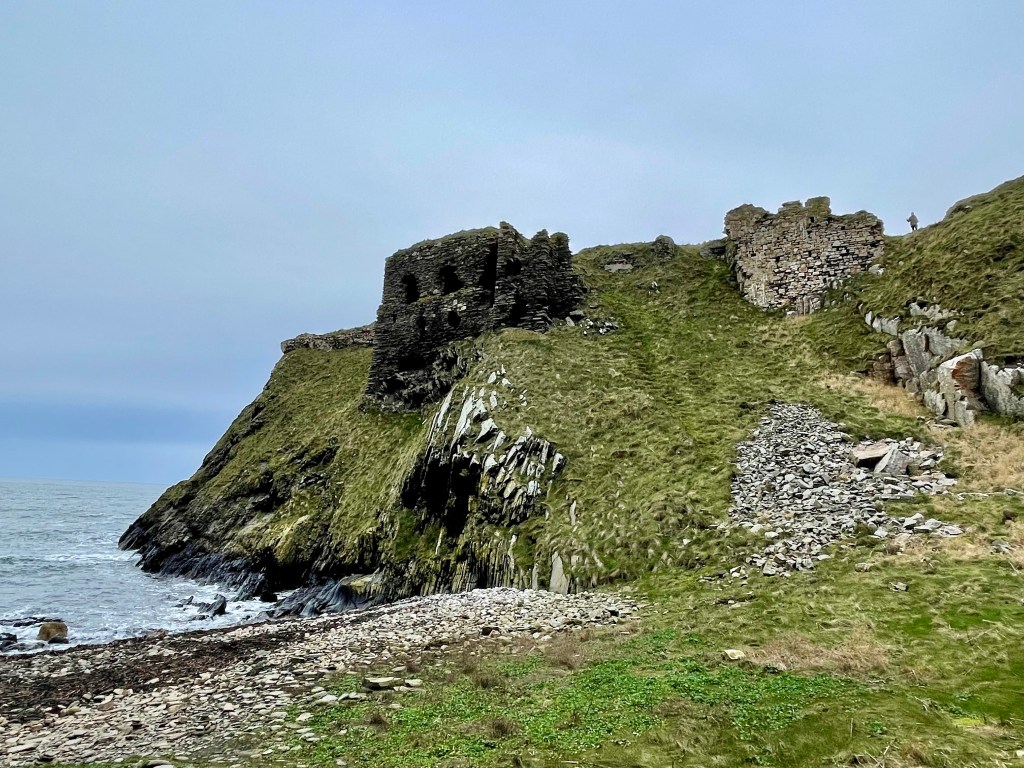
Carefully take the path down to watching where you walk and explore the area.
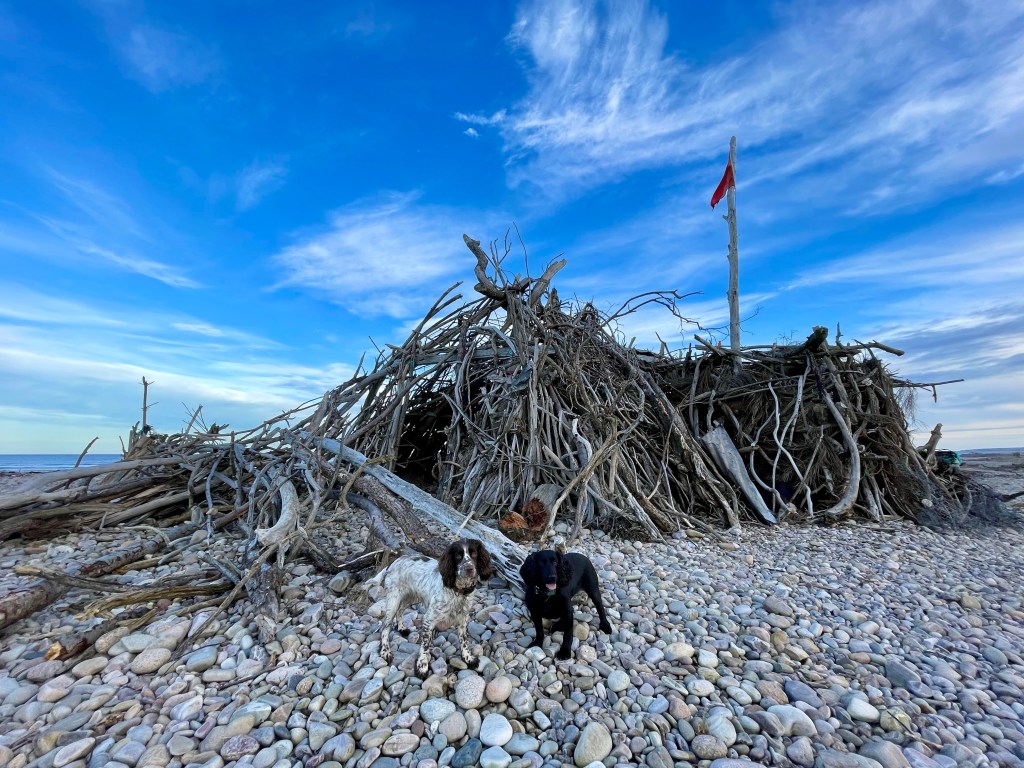
Why don’t you finish off with a visit to the stoney beach to the side for the full Findlater experience.
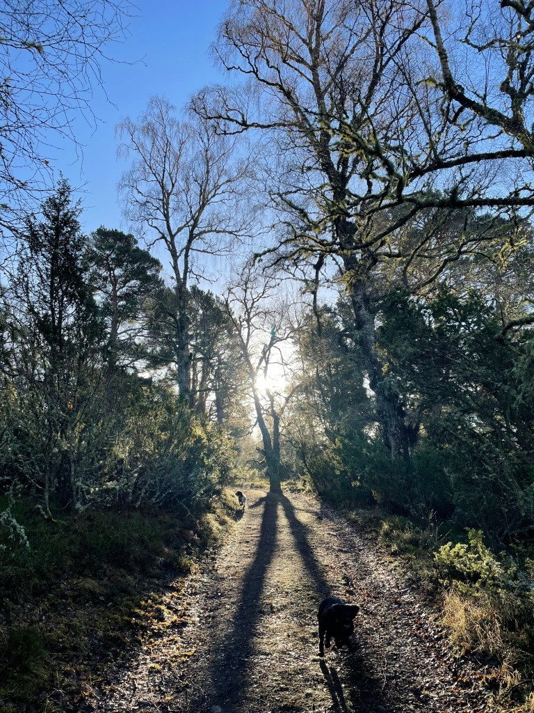
This is a stunning walk with epic views of the Cairngorm’s. Great walk if you want just a wee hill to climb rather than a munro!
Distance: Around 3.75 miles Time: 1 1/2-2hrs Level: Easy with some steep sections Terrain: Well maintained path, tar, grass track and woodland track. Access: Arrive by car parking at the entrance to Dalraddy campsite PH22 1QB.
Route: Starting in the carpark go to your left through the quad bike area and head under the railway bridge. Take a left after the bridge and head through the gate. Keep going till you reach the junction take a right here and head along the tarred road.
You will reach a fork in the road take the left hand track. Go up the track till you reach the gate and the grass park. Follow the path to the left edge of the park till you reach the opening on your left and the track that takes you in to the woods.
Looking back at the opening
Follow the track till you reach the fork. Take the left fork here and continue straight on. Keep a look out for the Waterloo cairn to your right that is worth stopping at. The cairn was erected by Marquis of Huntly, August 11, 1815 in memory of Robert Macara of 42nd Royal Highlanders, also Of Col. John Cameron of 92nd or Gordon Highlanders and their brave countrymen who glorious fell at the battle of Waterloo June 1815.
The Waterloo Cairn
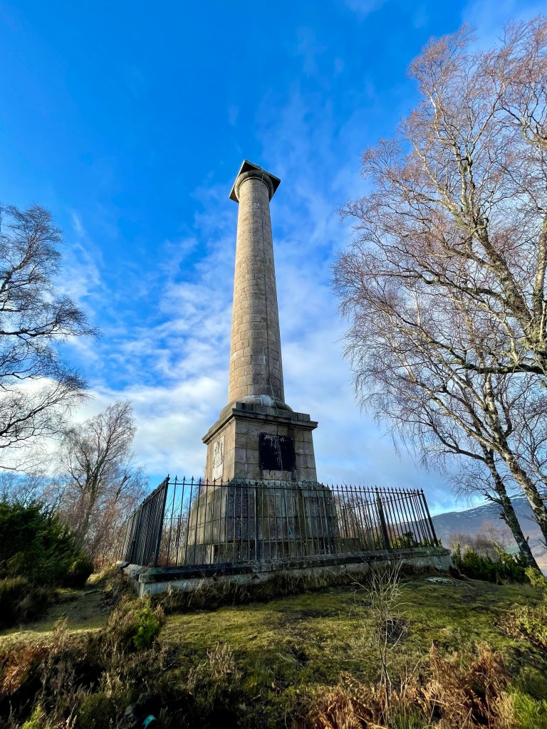
Not long after the Waterloo cairn the monument will come in to view. The track does go down hill a little before climbing back up.
The Duke of Gordon Monument
The track winds its way through the trees till you come to the Duke of Gordon Monument that commemorates the last Duke of Gordon who died in 1836. Once you have explored the area you return the way you came taking in the beautiful views.
Kingston drift wood hut was built by the locals and is an amazing place to visit. There is something added to it every time I visit!
Distance: 1 1/2 miles Time: 1hr Level: Easy Terrain: Grass track and pebble beach Access: Arrive by car, parking is available at corner Kingston road and Beach road. There is a no 34 Stagecoach bus from Elgin.
Route: This is a fantastic short walk leaving from the car park take the track to the left that runs past the back of the houses. Follow the track right along and it will narrow down to a path.
Kingston
Keep a look out for the ducks paddling in the water to your right.
When you get to the play park turn left and head back towards the beach hut. It is pebbles all the way so not the easiest to walk on so wear good footwear.
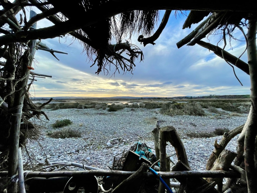
When you get to the beach hut make sure you explore it inside and outside and see if you find the visitor book. Please be respectful while you are there the locals after spent a lot of time and effort to build the hut,
Kingston beach hut
After exploring the area return the same way as you came.
I headed to Cullen for this walk but rather than going to the beach I headed up to the woods for a stroll round Crannoch wood and loch. With some beautiful views of the sea and the Bin Hill. This is quite a short walk and perfect in any season. Wear suitable footwear as maybe a little muddy.
Distance: 2.75 miles Time: 1hr Level: Easy with some elevation. Terrain: Grass track, woodland trail and pavement Access: Arrive by car parking is available in the square. There is a regular number 35 bus running from Elgin to Aberdeen.
Cullen and The Bin Hill
Route: The walk starts off in the square in Cullen head up Seafield Road past the Antiques Centre and then take a left along Seafield Place. When you reach the corner before heading along Logie Drive take a right up the grass track. There is a waymarker here. At the junction at the top take a right going away from Cullen.
A little ahead you will come to a gate go through the gate and turn left and go towards the ruined Logie House that you can see in the distance.
Logie House Ruin
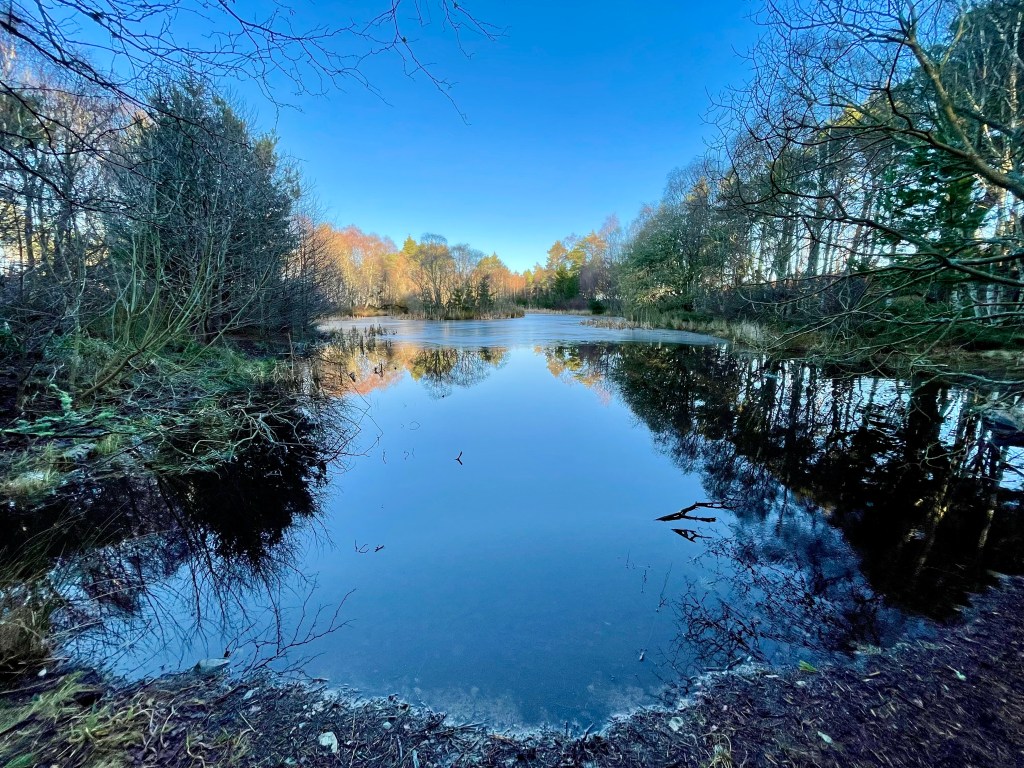
Just before you come to the ruin take a right at the waymarker, then take another right as you head towards the woods. When you reach the woods take a left when you see the path into the woods, then follow the track it will turn to the right Go past the small Loch I did explore a little here. Get back on the track and keep going straight ahead.
Crannoch Loch
You will pass the Den!
At the next junction take a right to return to Cullen. You will go over the bridge of the old railway line then skirt past a small carpark before reaching the outskirts of Cullen.
Careful walk along the track next to the road till you return back into Cullen and back to the square.
I headed to the beautiful Cairngorms for this walk which takes in Loch Insh, the stunning Uath Lochan’s and the River Feshie. This is a very peaceful walk in the wilderness with plenty of opportunities for wildlife spotting. I had several sightings of birds of prey along the way.
Distance: 7 ¾ miles Time: 3 ½ – 4hrs Level: Easy long walk with some elevation. Terrain: Mix of forestry track and paths with a small amount of quiet road walking. Access: Arrive by car following the signposts for Kincraig/Loch Insh outdoor adventure centre PH21 1NU. I did ask permission to park at the centre. There is a regular Stagecoach No 35 bus from Aviemore which is about a 20min walk from the Outdoor centre.
Loch Insh
Route: The walk starts off at the Loch Insh Outdoor Centre which is a fantastic facility offering a large array of activities as well as accommodation.
In the car park head down to the shore and you will see a sign for the Loch side trail which is part of the Badenoch way. This is a very well waymarked and easy to follow section with great views across the Loch and the first opportunity for wildlife spotting.
On the trail
Leaving the waterside carry on following the waymarkers through the woods till you come to a road with a house opposite. Cross the road here and turn right just after the house you will find an opening to re-join the path. The path is rather narrow here but only for a short time.
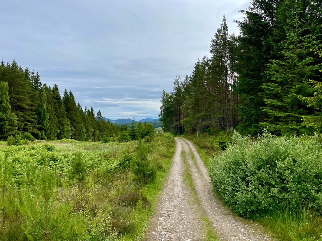
Keep on the waymarked trail and you will come to a fork and take the path to the left here. There is a long straight section, the Badenoch way turns off here to the right this is where you leave the way as you will carry straight on. About 250 yards after the Badenoch way turns off , you will take a left turn where you will find red trail markers.
View of Loch Insh
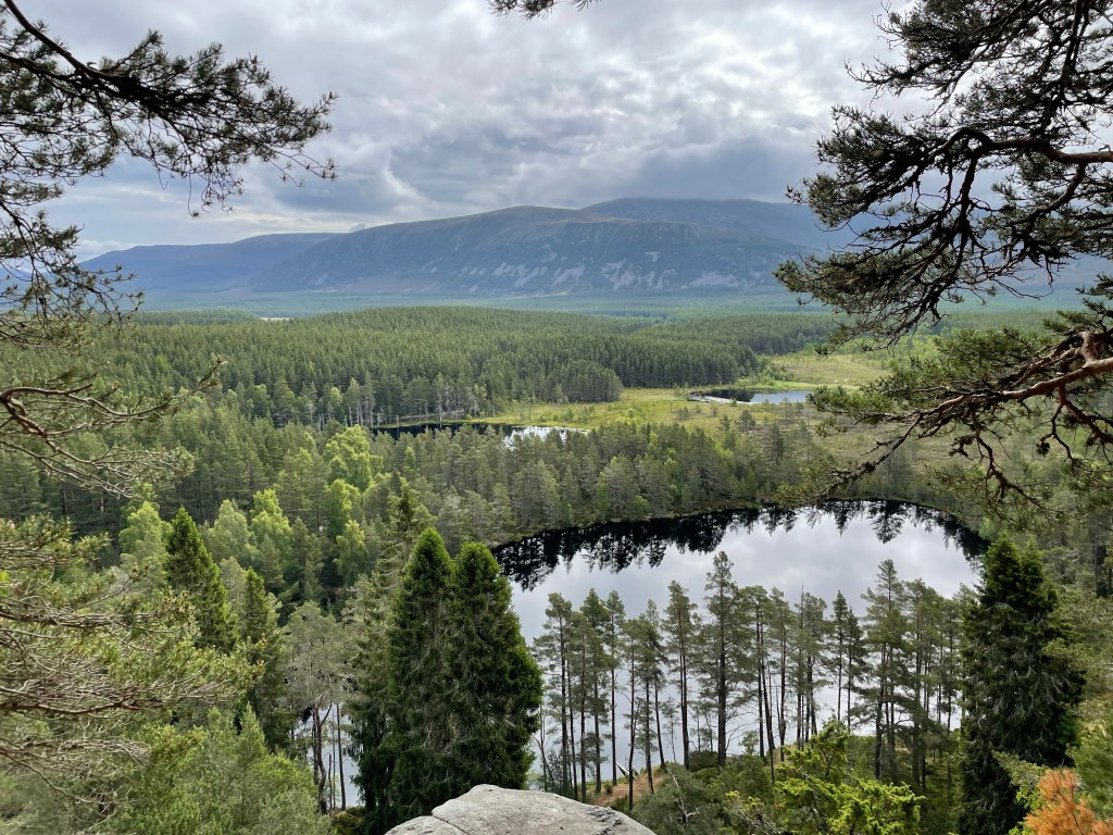
Here you will head up in to Farleeitter Crag where you will find a fantastic view of Loch Insh before you are looking down on the Uath Lochan’s once you have enjoyed the views the trail will start going downhill till you come to a junction take a left here after a short walk you will come to another junction where you will take a right to take you to the Lochan’s. This is a fantastic place to stop for a picnic with stunning views.
Uath Lochan’s
Carry on the trail before taking the next left, you come to a road. Take a right and walk along the road for a short stretch till you come to an opening to a house road end. Go into the opening and turn to your left you will find a right of way sign. Follow the sign passing by the houses. You will come to a U-shaped house, take the path to the right here. Carry on till you come to the side of the River Feshie. As you walk along the path and you will feel like you are in total wilderness with only the wildlife for company. There are plenty of opportunities if you want to dip your feet in the beautiful clear waters.
River Feshie
Keep following the path right along the riverside till you come to some houses then Feshie bridge on your right. You will find a path just along from the bridge to the right of the road.
Frank Bruce Sculpture Trail
Follow the path along till you reach a small car park which then leads you to the Frank Bruce Sculpture Trail which is starting to be reclaimed by nature as it was meant. The trail is worth the detour or take the path to the right which you will find is waymarked for the East Highland way. Follow the waymarkers you will come to a farm, the path will take a left before reaching a junction.
Loch Insh
At the junction take a right joining the Badenoch way again which you will follow till you return to the Loch Insh Outdoor Centre. Which is now a perfect time for coffee and cake at the Boathouse Bar and a well-earned rest!