Aberdeenshire Walks, Places to Walk

Exploring Portsoy

This is a great walk exploring round the sights of Portsoy! Nothing too taxing just a stroll round seeing some of the sights!

Distance: 2 1/4 miles Time: 1hr Terrain: Mix of grass path, pavement and tarred road Access: Arrive by car and head for the The Sail Loft, AB45 2RQ there is parking spaces between the Sail loft and the beach area. There are regular no 35 Stagecoach buses that drop off in the Main Street.

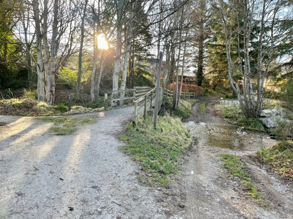
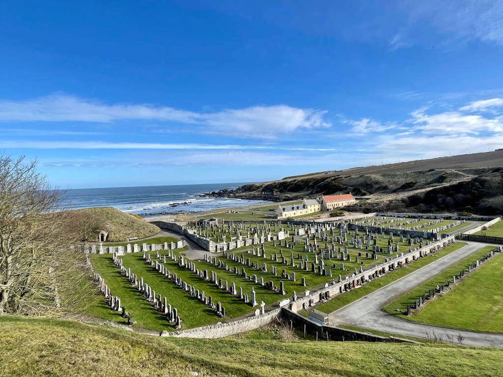
Route: Leaving the car park head towards the bridge and take the road on the left towards the graveyard. At the graveyard you will see a path that skirts round the edge of the graveyard to the side of the burn. Walk along the grass path till you reach the bridge. Head to the right here and keep going.

At the next fork take the path to the right and you will come to a great view of the Sail loft, beach and the opening of St Combs well. Keep going till you get to the silver gate where you can go and check out the well!

St Combs well is said to be first built in the 7th Century. The well 2ft diameter, and still flowing, is now covered by a stone cupola with an arched entrance. It was restored in 1893.

St Combs well

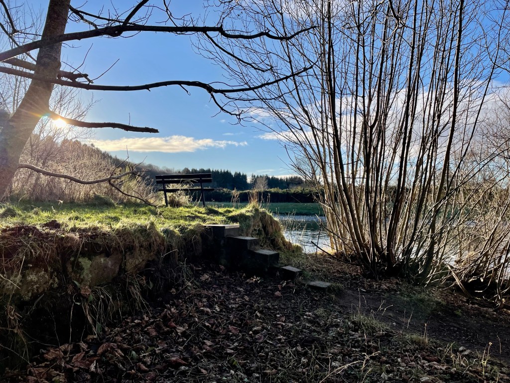
Back on the path head down the steps and back towards the caravan park. Follow the road along past the front of the caravan park. Keep going past the Salmon bothy till you reach the new harbour. Take a left at the harbour along to the old harbour and the dolphin sculpture.

Old Harbour

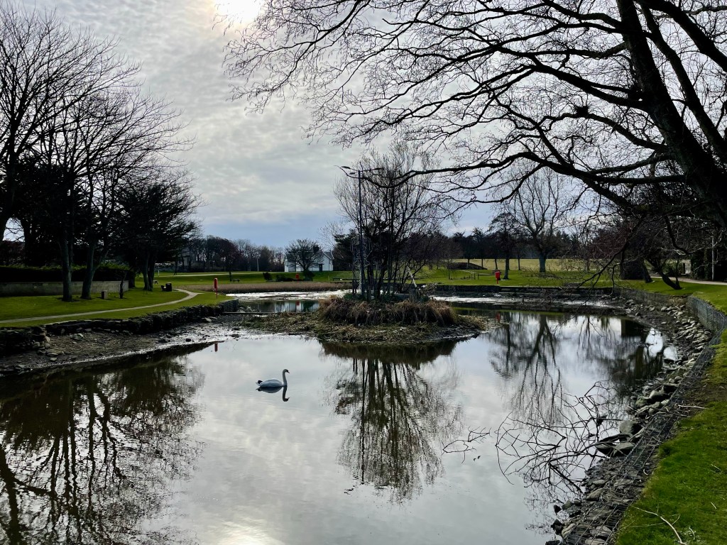
Once you have explored the harbour area walk up North High Street till you get to the square and then along South High Street till you get to Main Street. From here cross over and head for the sign post for Loch of Soy.

Once through the carpark take the path round the Loch keeping your eyes pealed for paddling ducks and swans. Don’t forget to check out the wooden building beside the Loch that used to be the old railway station building now used as the Scout Hut.

Loch of Soy

Once round the Loch go back out the carpark and take a wander along the Main Street checking out some of the lovely shops or have some Portsoy Ice-cream. You will come to the signs for the Caravan park follow the signs and return to the start.

Moray Walks, New Walk, Places to Walk

The Intake and Canal Fochabers

This is a beautiful trail that not only takes you along a section of the River Spey it gives you a chance to see the remains of a very interesting hydro scheme that was way ahead of its time dating back to the early 20th century, the initiative came from the Duke of Richmond and Gordon who for some years envisaged his Castle being lit by electricity.

Paved area with rockery at each side with 2 large stones and view of the river spey in front
View of the River Spey

Distance: 2 ¾ miles Time: 1hr Level: Easy low-level walk Terrain: Well walked woodland paths with some tarred and pavement walking. Access: Arrive by car, parking is available at the Speyside Way car park opposite the opening of Gordon Castle at IV32 7EH. There are also good bus links from Stagecoach with a stop near the start of the walk.

Route: At the car park take a left and head towards the memorial gardens where you get an amazing, framed view of the River Spey. To the left you will see some steps, go down them and follow the path along. There is a small opening if you want to get a good view of the fish ladder. Back on the path go over the footbridge at the fish ladder you will see the signpost to the Intake.

Footbridge over the ford, with trees and sun shining through
Footbridge at the salmon ladder

Once over the footbridge you will pass some big houses, then there is a fork in the road, take the right fork towards the wooded area. Once on the wood track you will see a wayward marker post, just after you pass it take the opening to the right on the narrower path. This is where you will first see the derelict canal. The path can be quite uneven here and wet but well worth walking and getting dubby boots for.

Old canal filled with leaves and debris
Old canal

Keep on this path, it will eventually come to the edge of the river where you will get some great views of Ben Aigan in the distance. Follow the path right along the river and you will come to some steps and a bench. This is a great place to stop for a picnic and do some bird spotting on the river.

Small set of steps with grass area and view of the river
Just at the intake

Just beyond the bench you will see a wee opening and a little overgrown path where you will find an information board and the intake where the water came in to power the scheme. You still see the grid that was put there to keep fish and debris out. The water ran along the lade (known as the ‘Canal’) to the power station to drive the turbines to produce the electricity.

Head back to the bench there is a path at the right that will take you along beside the edge of the canal. Keep your eyes peeled along here as there are several scrap cars buried in the undergrowth in the canal which were dumped many years ago. Keep on the same path it will take you back to the wayward marker post where you turned off.

Scrap cars in the undergrowth
Scarp cars

Once back on to the tarred road, at the fork keep right, when you get to the shed at the end of the road turn right on to West St. Halfway along you will see a waterfall on the Burn of Fochabers and a wooden foot bridge running over it. Go over the bridge then take the next right on to George St. This will take you to Fochabers Square. On the other side of the road opposite the fountain you will see a large streetlamp that commemorates the opening of the scheme. Which is a great way to finish the walk.

From the square you can just go along the High St past the traffic lights and bowling green and you will return to the carpark. There are a few cafes on the High St and a lovely ice-cream shop if you fancy some refreshments after your adventure.

Large old light with fountain and town clock in Fochabers Square
The Square Fochabers

Moray Walks, New Walk, Places to Walk

Walk to the Jean Carr’s Stone

This is a interesting and possible slighty creepy place to visit near Fochabers! Details of the stone below is from the information board at the stone!

Information board surrounded by trees with stone in the distance
Jean Carr stone information board.

The stone is a large conglomerate boulder left from the ice age I million years ago and has probably lain here more or less unnoticed until the arrival of Jean Carr in the 18th century.

The story goes, although only pieces remain, that a young girl named Jean Carr was, to quote a sentence from old records, “Fan she wis a lassie, she was chained in the hoose by her father, an fan he dee’t, Jean said there wis two prisoners relieved.”

After this she fled, took to the open road and led the life of a gypsy, becoming a familiar figure in the area between Banff and Fochabers.

She led this happy life under the stars until the birth of her child. The local authorities snatched the child and housed it for safety with the village nurse. In an attempt to recover the child Jean tore at the thatched roof of the nurse’s home, only to be arrested and put in jail. After this incident the child was never seen again and Jean, now childless took to helping herself to other people’s, becoming a known nuisance in the local towns. At night Jean would seek the shelter of the great rock.

Large stone surrounded by trees
Jean Carr stone

“Lock up your bairns, Jean Carr’s in toon!” was the cry when she descended on Fochabers!

Some time later it was announced in a local paper that her son had died and Jean’s life was never the same again. At nights she would be seen disappearing in to the countryside and for many years took refuge under this stone. She was still seen wandering the byways as an old frail woman until one morning she was found, wrapped in her tattered shawl, lying in her favourite place under the ancient friendly rock cold and dead.

Distance: 2 1/4 miles Time: 1-1 1/2hrs Level: Easy with elevation Terrain: Forrest road and woodland track. Access: From Fochabers turn left at the chipshop and keep going out of town for approx 1 1/2miles. Just before you come to the Earthpillars car park on the right take the track on the left. Drive up past the opening to the house on the right till you come to a small carpark and gate into the Ordiequish woods. Click for google map link!

Route: Leaving the carpark head through the gate and start your walk on the forestry road. Just over half a mile in the road will take a turn to the left and shortly after you will come to a junction take a left here.

Wood track with trees at each side with dog running

The road will ascend straight uphill at around a mile you will pass two openings at the right before you will see an opening to the left and a narrow path. Take this path and you will soon see the information board and the stone. It’s hard to believe Jean would hike away up here but we all have that one place we love to visit!

Small path surrounded by trees
Path to the stone

Return by retracing your steps back to the carpark. There is a circuit but due to recent storms I decided that it was best not to carry on in case of falling trees.

1 black cocker spaniel and 1 brown and white cocker spaniel standing on top of stone surrounded by trees
Dixy and Suzi