Aberdeenshire Walks, Places to Walk

Banff and Whitehills Circular

Distance: 5 ½ – 6 miles Time: 2 – 3 hrs Level: Easy with some elevation Terrain: Mix of pavement, track, road, and beach Access: Car parking is available at the Quayside car park (AB45 1HQ). Regular buses run between Elgin and Aberdeen, with the nearest bus stop located at Chalmers Hospital, just a short distance from the start of the walk.

This is a wonderful coastal walk from the Aberdeenshire town of Banff to the neighbouring village of Whitehills. Before setting off, check the tidal times so you can enjoy walking along the beach.

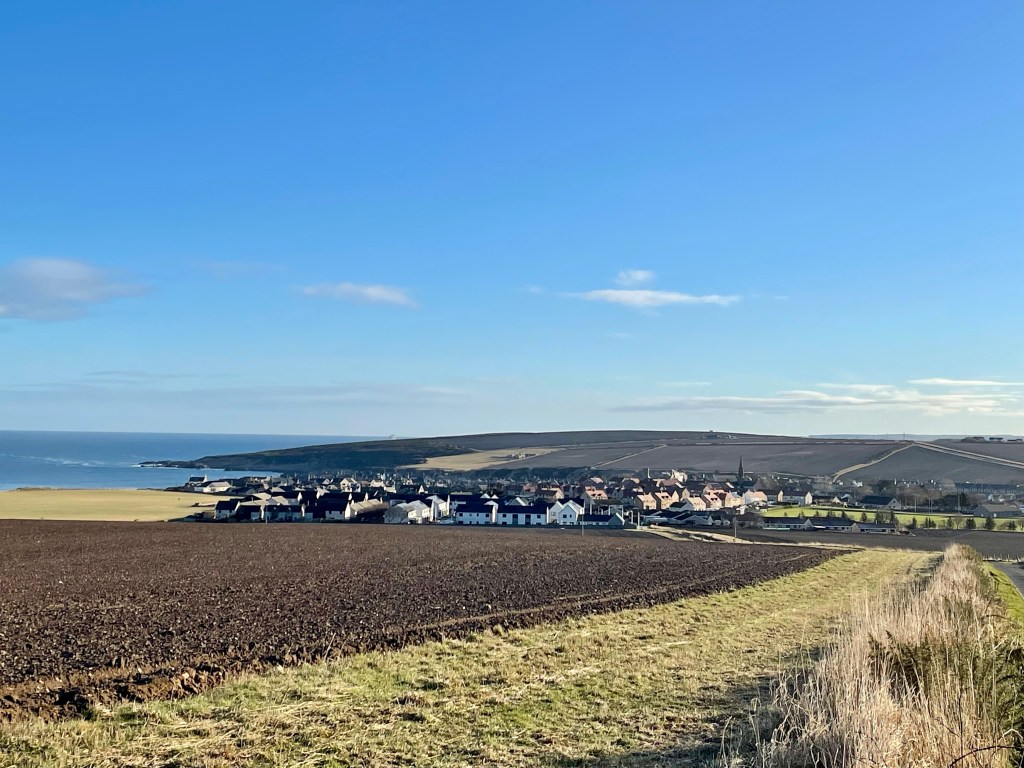
From the Quayside car park, head towards the beach, taking the coastal path along Scotstown. Watch for cormorants drying their feathers on the rocks, and you may even be lucky enough to spot dolphins passing by.

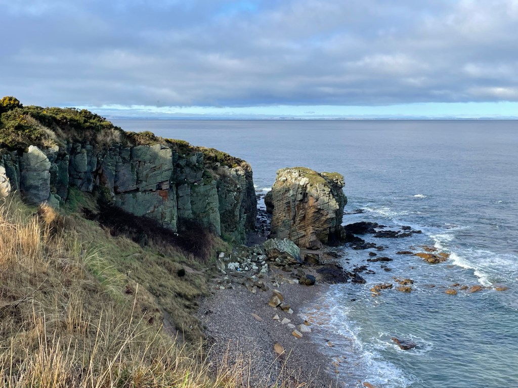
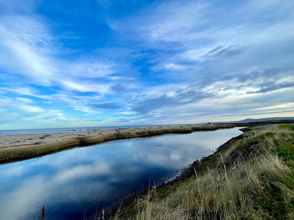
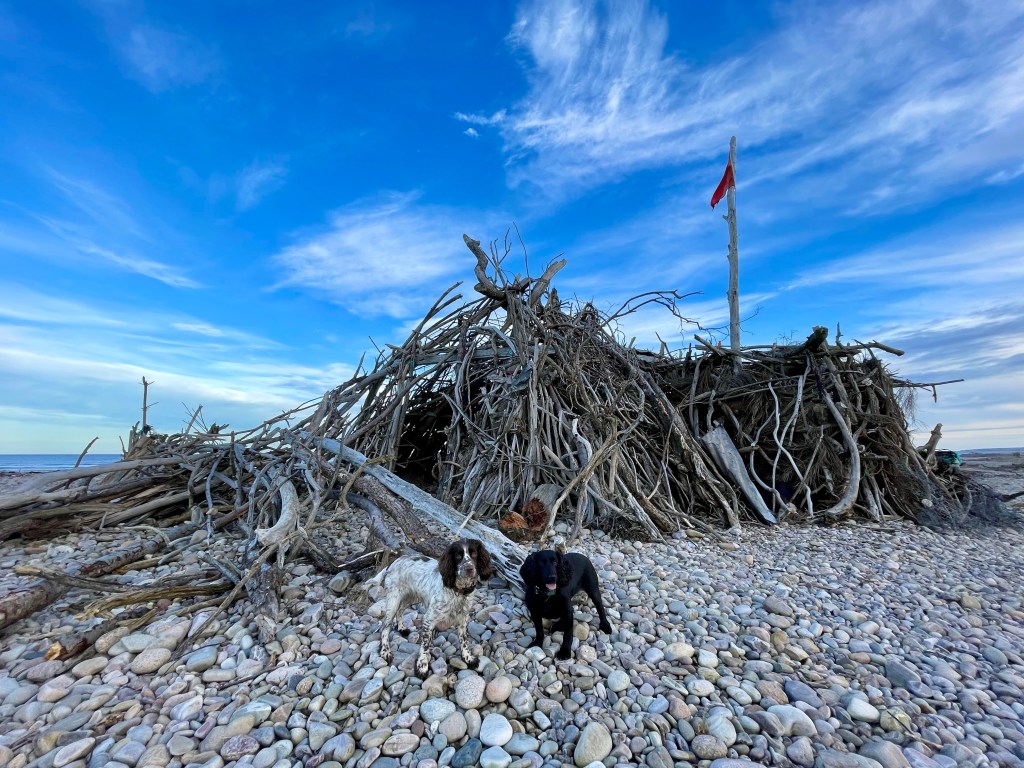
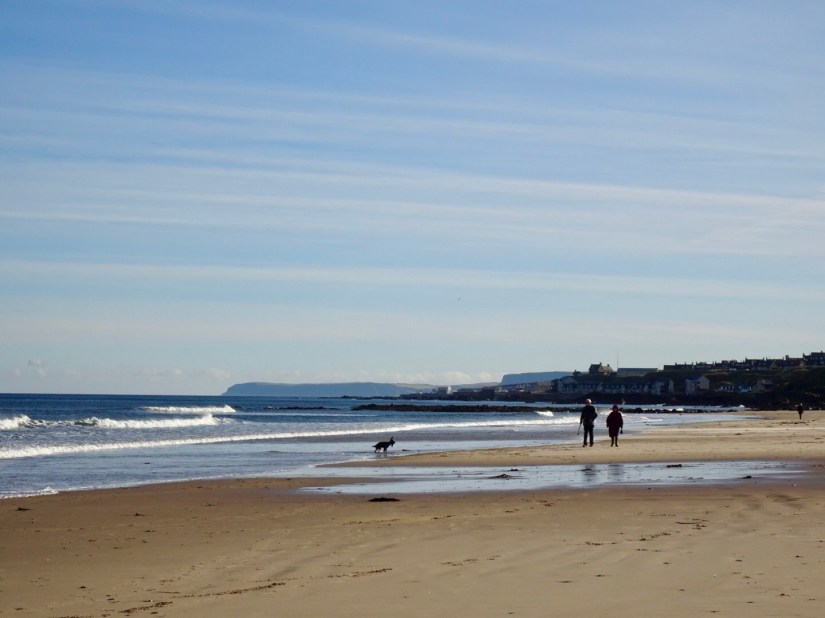
Soon, you’ll come to steps leading down to the beach if you’ve timed the tide right. Banff Links is a fantastic beach to walk along, and on a sunny day, it’s lovely to take a wee paddle as you stroll. When you reach the end of the caravan park, take the ramp on your left to return to the path.

Follow the path and go over the footbridge until you reach a fork. Take a right here, and shortly you’ll arrive at Blackpots Playpark and Harbour.

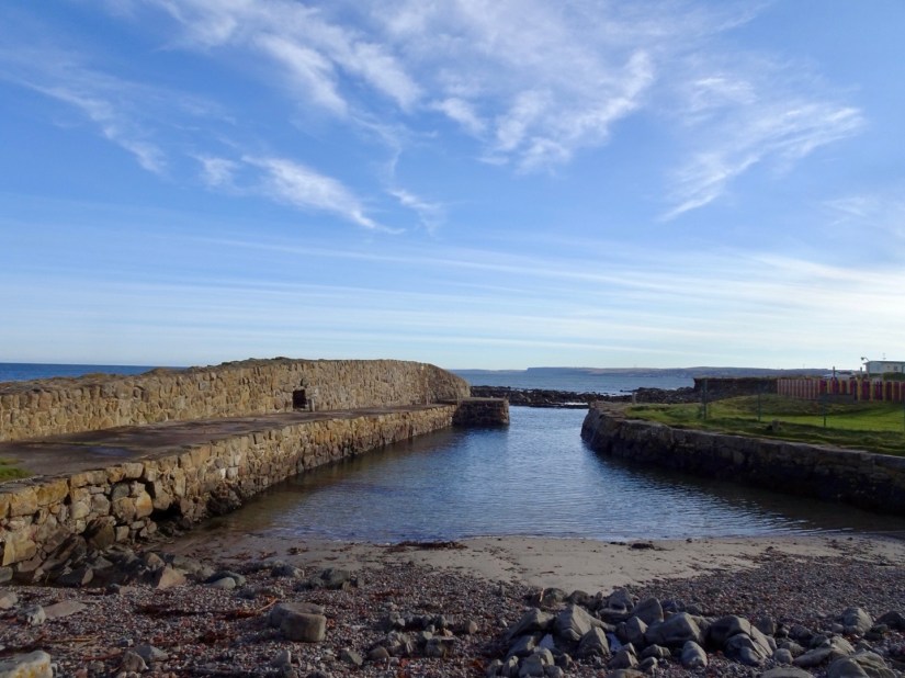
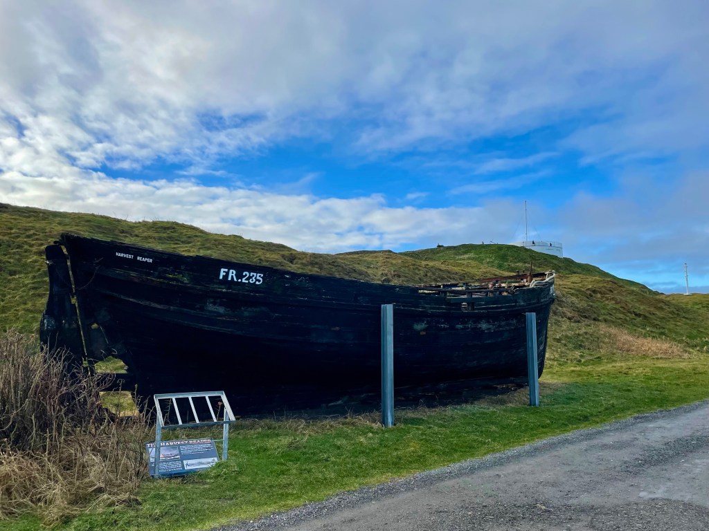
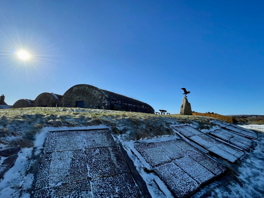
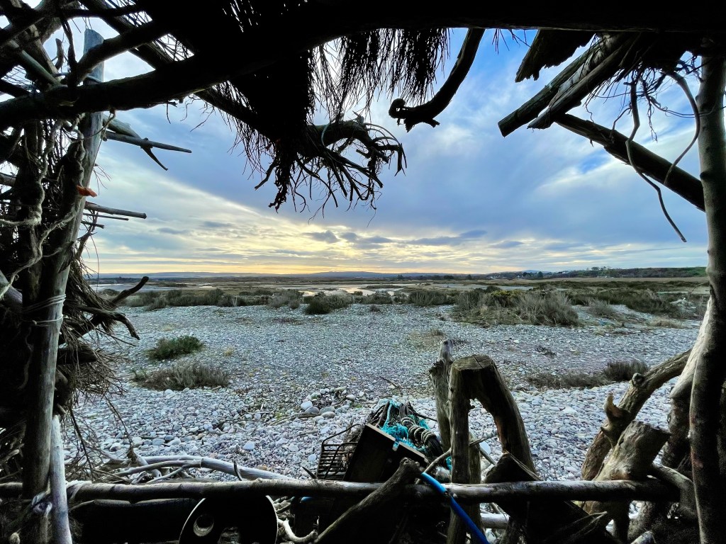
The small, disused harbour was built in the late 18th century. The playpark was a favourite spot for my kids when they were younger, and I have fond memories of enjoying fish and chips with my mum while the kids played. fter the playpark, you’ll come upon the Fisherman’s & Seafarers’ Memorial and Whitehills Marina.

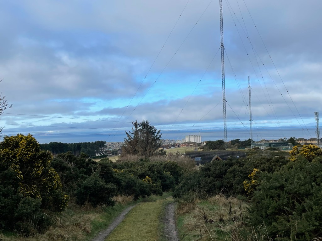
Continue along the road, passing Downies Fish, and keep an eye out for the “Light the North” lighthouse.

Stay on Seafield Street until you reach the post box and telephone box then take a left along Loch Street. Continue on Loch Street until you leave Whitehills. Soon, you’ll come to the coastal path on the left, take this path back towards Banff.

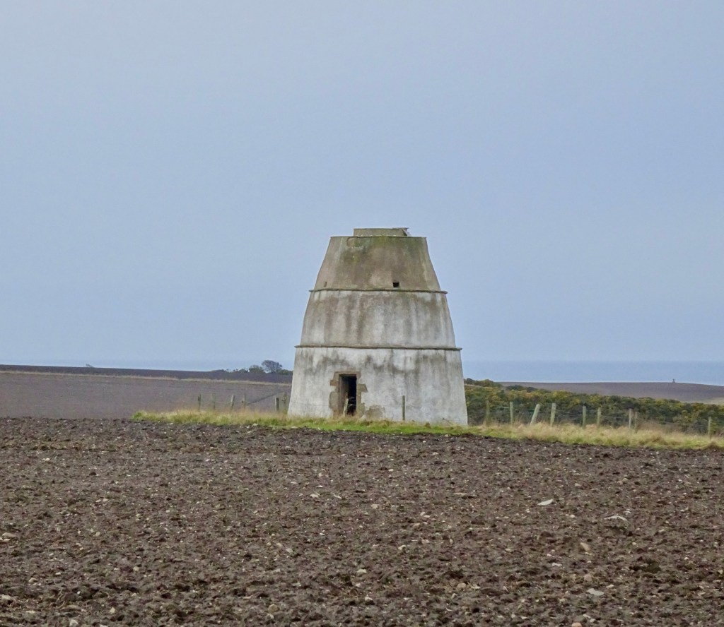
Along the coastal path, you’ll find the Red Well. The name comes from a spring that emerges from the ground, leaving red deposits, possibly due to iron content. The nearby beehive-shaped structure is thought to have been built by the Romans.

After the Red Well, continue on the path until you reach a fork just before the footbridge. Take the fork to the right and follow the track to a junction. Take a left here, follow the road over the bridge, and continue until the road splits.

Take the road on your right, which will lead to the Banff Links car park. Turn right and walk through the car park. At the other end, you’ll find a path with a gate. Go past the gate and continue along the path. After the third blue pavilion, you’ll come to another fork; take the track to the left, passing a small stone building (possibly an old icehouse).

Stay on this path as it winds through Scotstown. You’ll pass behind a row of houses; at the end of these, you’ll see some sheds. Take a left here to return to the Quayside car park.

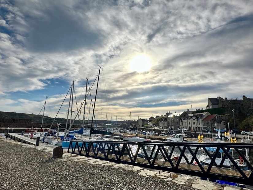
Next to the car park, you’ll find the recently upgraded Banff Harbour, which is worth a visit before finishing your walk. You’ll enjoy lovely views of Macduff from the harbour.

Moray Walks, Places to Walk

Burghead and Clarkly Hill Circuit

Distance: 4 ¾ miles Time: 2hrs Level: Easy with some elevation Terrain: Mix of pavements, coastal trail, woodland trail, and country road. Access: Arrive by car, parking available at the opening of the caravan park. Follow the signs for the caravan park and use the car park on the left-hand side using postcode IV30 5RP. There is a No32 Stagecoach bus from Elgin that drops off not far from the start.

This beautiful walk on the Moray coastal trail takes you along past the harbour and on to the old railway line path with a stunning coastal view and a chance you may see dolphins passing by. There are an abundance of historical sites along the way with great information boards!

Route: Leaving the car park follow the path that takes you along to the harbour. The harbour itself was built by Thomas Telford in the early 1800’s with impressive three storey warehouses. Three of the warehouses still remain and have now been converted into flats.

Once you pass by the warehouses take the stairs up to some great views of Burghead bay. Turn right along to the visitors’ centre in the old white round building, here you can find out about Pictish Burghead dating back to 400AD.

Once you have explored the centre, head towards the old anchor and you will see the Clavie mound. This is where on the 11th of January every year Burghead celebrate their New Year with a unique fire festival called the burning of the Clavie. The significance of the 11th January dates back to the 1750’s

From the Clavie mound, head towards the waterside and turn right along the tarred road, where you will find the Harvest Reaper boat that was originally built in Fraserburgh in 1931 and was finally berthed here in 2015. There are always plenty of seabirds to look out for as you walk along the water’s edge.

Further on you will pass by the Maltings and on to the coastal path. You will come to St Aethan’s Well and onto the disused quarry.

There are several way markers for the Clarkly Hill short walk, ignore these. You will pass under an old railway bridge before coming to the Cummingston Crag. The sandstone crag is a popular sea cliff for mountain climbers, and you may see some climbing the Prophet Walls (as it is known) as you are walking past!

Once under the second old railway bridge you find an opening on the left-hand side; this path will double back before going over the top of the bridge. Head straight on here until you arrive in Cummingston.

At the junction you will see the sign post a little to the left for Clarkly Hill. Cross over the main road and up the country road ahead. Looking over to the left and you will get some great views of Hopeman in the distance.

You will soon come to your next way marker taking you onto a track on your right. This will take you past a pig farm before coming to your hext sign post. Here you will go through the gate and straight ahead into a wooded area.

The viewpoint is unfortunately overgrown now, turn right at the fence and follow the path through the wood till you come to the gate at the other side.

From the wood you will carry on down the road back towards Burghead taking in the views ahead. Once past the masts go through the gate and back to the main road. Cross over and turn left here until you come to the junction to turn right, back in to Burghead.

Follow the main road back until you come to the community gardens. From here turning left to arrive back at the carpark.

Moray Walks, Places to Walk

Speybay – River Spey Viaduct Circuit

Distance: 2 miles Time: 1 hr Level: Easy Terrain: Good path, pavement and road Access: Arrive by car there is plenty of parking at the Speybay dolphin centre IV32 7PJ (donations for parking)

This is a fab short circuit walk from Speybay via the Spey viaduct. The walk is all on the flat with a good path so family and buggy friendly!

Route: From the car park head for the information board and you will see the path to the left that runs along the side of the river. Head along the path over the wooded footbridge and keep going!

You will follow this path all the way along till you come a 4 way junction. Take the road to the right just before the sign to take you along to the banks of the river and to get a great view of the viaduct.

To return back to Speybay. Go back to the junction and take the track that takes you to the main road. When you get to the main road cross the road on the the pavement and take a left back towards Speybay.

Once you are back to Speybay take a left at the Bay golf club and head back to the carpark.

Aberdeenshire Walks, Places to Walk

Walk to Findlater Castle

Findlater is a ruined castle in Aberdeenshire and only a couple miles from Cullen. It is the old seat of the Earls of Findlater and Seafield, sitting on a 50 foot-high cliff overlooking the Moray Firth.

Distance: 1 mile Time: 1hr Level: Easy but may be more difficult if the path is muddy some elevation. Terrain: Grass track and narrow possibly muddy path. Access: Arrive by car heading east from Cullen on the A98 turn left up road sign posted to Findlater Castle. The road takes a sharp corner to the right then take the next left after the first house. Take a left at the house and there is parking round the back of the large barns. Postcode is AB45 2UD. Please keep dogs on leads at all time.

Route: Once parked take the track to the right past the back of the barns. The track will turn left, keep going till you come to the junction.

Round Doocot or Dovecot next to a ploughed field
Findlater Doocot

You can take a left at the junction to head along to the Findlater Doocot or head straight on to the Castle.

View of ruined castle in the cliffs with beach to left hand side
Findlater Castle from view point

There is a fab viewing area which if you don’t want to go any further you can get a great view and some cracking photos.

Castle ruins with sea to left hand side

Carefully take the path down to watching where you walk and explore the area.

Door way of ruined castle with coastal view

Why don’t you finish off with a visit to the stoney beach to the side for the full Findlater experience.

View of castle from the beach
Findlater from the beach
Moray Walks, Places to Walk

Walk to the Kingston beach hut

Kingston drift wood hut was built by the locals and is an amazing place to visit. There is something added to it every time I visit!

Distance: 1 1/2 miles Time: 1hr Level: Easy Terrain: Grass track and pebble beach Access: Arrive by car, parking is available at corner Kingston road and Beach road. There is a no 34 Stagecoach bus from Elgin.

Route: This is a fantastic short walk leaving from the car park take the track to the left that runs past the back of the houses. Follow the track right along and it will narrow down to a path.

Estuary area at Kingston
Kingston

Keep a look out for the ducks paddling in the water to your right.

When you get to the play park turn left and head back towards the beach hut. It is pebbles all the way so not the easiest to walk on so wear good footwear.

Shingle beach with blue skies

When you get to the beach hut make sure you explore it inside and outside and see if you find the visitor book. Please be respectful while you are there the locals after spent a lot of time and effort to build the hut,

Large beach hut made with drift wood
Kingston beach hut
View of shingle beach out the beach hut window

After exploring the area return the same way as you came.

Highlands Walks, New Walk, Places to Walk

Loch Insh, Uath Lochan’s and River Feshie circuit

I headed to the beautiful Cairngorms for this walk which takes in Loch Insh, the stunning Uath Lochan’s and the River Feshie. This is a very peaceful walk in the wilderness with plenty of opportunities for wildlife spotting. I had several sightings of birds of prey along the way.

Distance: 7 ¾ miles Time: 3 ½ – 4hrs Level: Easy long walk with some elevation. Terrain: Mix of forestry track and paths with a small amount of quiet road walking. Access: Arrive by car following the signposts for Kincraig/Loch Insh outdoor adventure centre PH21 1NU. I did ask permission to park at the centre. There is a regular Stagecoach No 35 bus from Aviemore which is about a 20min walk from the Outdoor centre.

Loch Insh

Route: The walk starts off at the Loch Insh Outdoor Centre which is a fantastic facility offering a large array of activities as well as accommodation.

In the car park head down to the shore and you will see a sign for the Loch side trail which is part of the Badenoch way. This is a very well waymarked and easy to follow section with great views across the Loch and the first opportunity for wildlife spotting.

On the trail

Leaving the waterside carry on following the waymarkers through the woods till you come to a road with a house opposite. Cross the road here and turn right just after the house you will find an opening to re-join the path. The path is rather narrow here but only for a short time.

Keep on the waymarked trail and you will come to a fork and take the path to the left here. There is a long straight section, the Badenoch way turns off here to the right this is where you leave the way as you will carry straight on. About 250 yards after the Badenoch way turns off , you will take a left turn where you will find red trail markers.

View of Loch Insh

Here you will head up in to Farleeitter Crag where you will find a fantastic view of Loch Insh before you are looking down on the Uath Lochan’s once you have enjoyed the views the trail will start going downhill till you come to a junction take a left here after a short walk you will come to another junction where you will take a right to take you to the Lochan’s. This is a fantastic place to stop for a picnic with stunning views.

Uath Lochan’s

Carry on the trail before taking the next left, you come to a road. Take a right and walk along the road for a short stretch till you come to an opening to a house road end. Go into the opening and turn to your left you will find a right of way sign. Follow the sign passing by the houses. You will come to a U-shaped house, take the path to the right here. Carry on till you come to the side of the River Feshie. As you walk along the path and you will feel like you are in total wilderness with only the wildlife for company. There are plenty of opportunities if you want to dip your feet in the beautiful clear waters.

River Feshie

Keep following the path right along the riverside till you come to some houses then Feshie bridge on your right. You will find a path just along from the bridge to the right of the road.

Frank Bruce Sculpture Trail

Follow the path along till you reach a small car park which then leads you to the Frank Bruce Sculpture Trail which is starting to be reclaimed by nature as it was meant. The trail is worth the detour or take the path to the right which you will find is waymarked for the East Highland way. Follow the waymarkers you will come to a farm, the path will take a left before reaching a junction.

Loch Insh

At the junction take a right joining the Badenoch way again which you will follow till you return to the Loch Insh Outdoor Centre. Which is now a perfect time for coffee and cake at the Boathouse Bar and a well-earned rest!

Aberdeenshire Walks, Places to Walk

Portsoy and Sandend circular

This beautiful walk takes in the old harbour that dates back to 1693 that has been recently used for a film set for Peaky Blinders and Whisky Galore. You will explore the coastal path that runs along past the cliffs between Portsoy and Sandend with many paths that branch to do yuor own exploring before arriving at the stunning Sandend beach and returning along a quiet country lane with coastal views.

Distance: 5 miles Time: 2hrs Level: Easy with some elevation Terrain: Tarred road, pavements, coastal trail paths and beach Access: Arrive by car, there is plenty of parking avalible in the The Square, Portsoy, AB45 2NX The No35 service bus runs between Elgin and Aberdeen and drops off on Seafield Street only a short walk along South High Street to the start of the walk.

Route: At the square head down North High Street past the Boyne Hotel till you come to the Old Harbour. This is a great chance to have a look around with some fabulous photo opportunities. Head over to the left of the harbour where you will find the stunning bottlenose dolphin statue that was made by local artist Carn Standing.

Next to the statue you will find the ruined remains of a cottage that has a lovely view out the window.

To the left of the ruin there is a narrow path where you can skirt round the wee hill or go up the top to get a great view of Portsoy.

Carry down the narrow path which will take you to a small yard, follow the path towards the houses where you will find a waymarker post for the coastal trail.

The path will skirt past the houses till you finally leave Portsoy and into the countryside.

Not long after you leave the town, Portsoy Lido the disused outdoor pool will come into view. The lido was opened in 1936 and was in use until it closed in 2001.

Just after the Lido there is a short stretch on a narrow country lane so be careful there maybe cars here.

The very well-marked path carries on along the coastline with plenty of paths off to the side if you are keen to look for seabirds along the cliffs. You will reach Redhythe Point where there are remains of a building which would have been part of a WW2 rifle range that was once there.

After Redhythe Point the coastal path winds along the edge of the cliffs you can choose to stick to the main path or explore the narrower paths closer to the shoreline. You will come to a grassy track with heather at each side on the left in the not too far distance you will see a vehicle barrier (that is your return route).

Turn right to pass the bay with the ruined house.

Once past the small bay you will come to a gate. go through it and down the steep path and on to the steps to Sandend beach.

At the end of the beach you will find a WW2 pillbox along with other remains from the war which can be found in several areas around Aberdeenshire and Moray.

You could stop for a picnic here and walk along the beautiful sandy beach or even explore Sandend more before returning back up the steps and the steep path and through the gate. Once past the small bay head to the right towards the vehicle barrier. Once past the barrier head straight on past the big house on your right.

Continue straight along the country lane. You will have some great views of the coast and Portsoy as you are walking back. Once you arrive in Portsoy you will go along the street named Park Crescent which then goes on Cullen Street before heading straight back to the square where you began. There are some lovely wee shops and cafes in Portsoy if you have plenty of time they are worth a look.