Moray Walks, Places to Walk

Explore Black Water Lodge and Dead Wife’s Hillock Hike

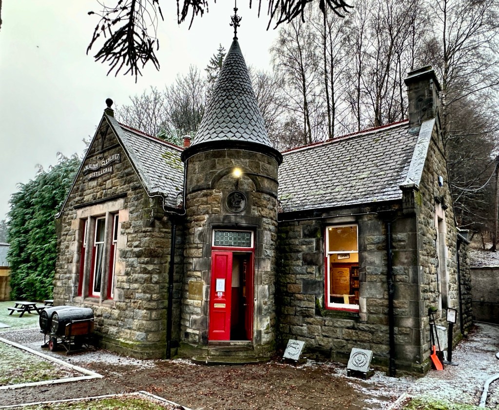
Distance: 7 1/2 miles Time 3 – 4 hrs Level: Moderate with elevation. Terrain: Grass track and Landrover tracks. Car parking is available at The Steplar car park (AB54 4HY). Google Maps will take you to the correct location. There is no public transport to the car park. The area is part of the Dorenell Wind Farm. Only a few miles along the road you will find the Dorenell Visitors Centre at AB54 4EL. Here you will find a public toilet and lots of information about the trails in the area. 


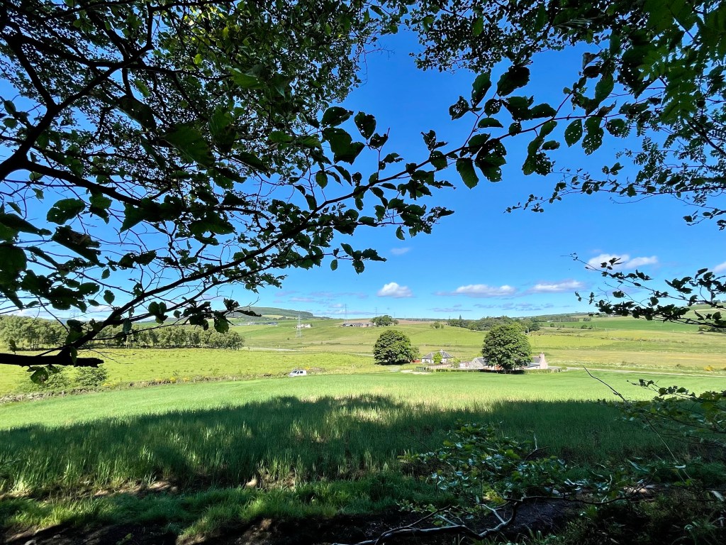
This is a fantastic walk in the beautiful and remote Cabrach, located between Dufftown and Rhynie. Cabrach is known for its rugged landscape and remoteness. It has to be one of my favourite places to escape for an adventure. With a mix of wildlife, history and amazing views it really is an epic place to visit. 


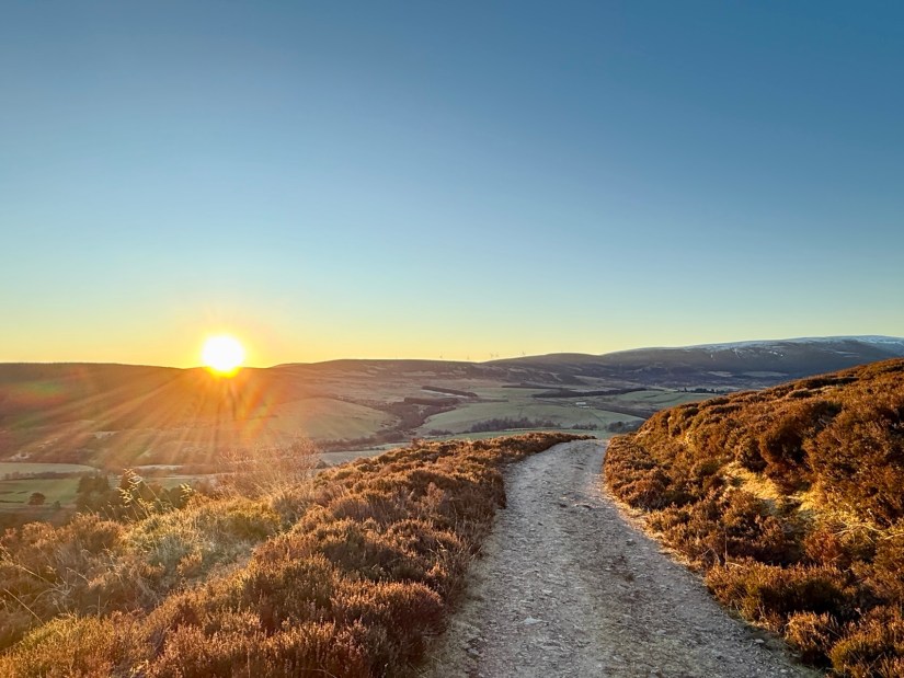
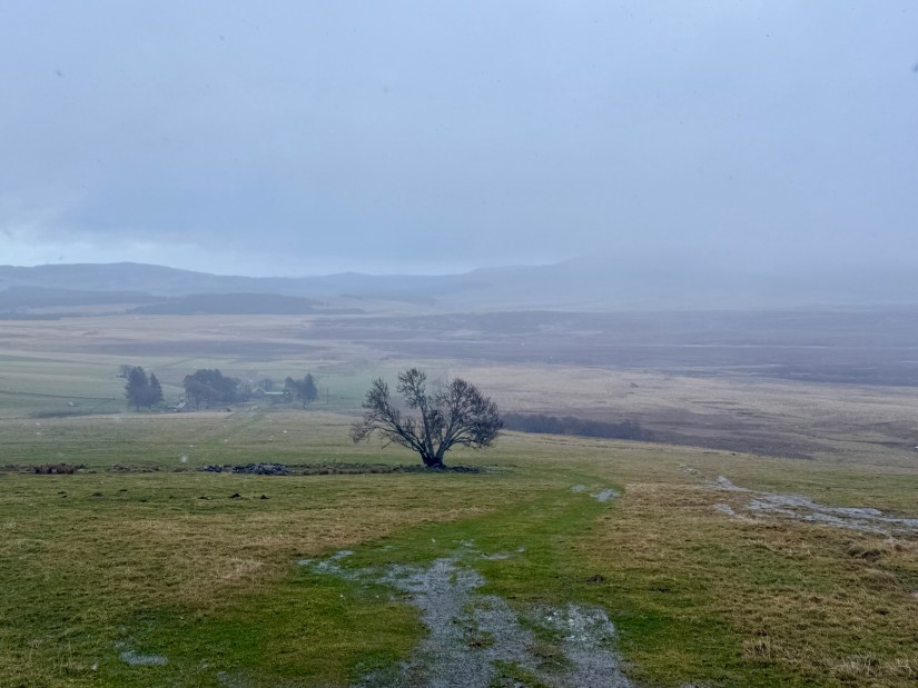
At the start of the walk, there is an information board with the wildlife you may spot along the way as well as a map. From the car park, go through the gate and head up the grass track toward the solitary tree visible on the hill. Once you reach the tree, go through the gate and continue onto the Land Rover track. Don’t forget to look back!

The climb up Dead Wife’s Hillock is steep but worth it as you will get 360 degree views on a clear day. The hill’s eerie name is said to come from a story of a woman who perished there in the late 17th century during a famine. She died of starvation and was found with a child still alive, attached to her breast.

As I walked up the hill, I spotted a herd of deer on the left side. I didn’t see any more up close. It was a quiet day in the sky for birds, but golden eagles have been spotted in this area.

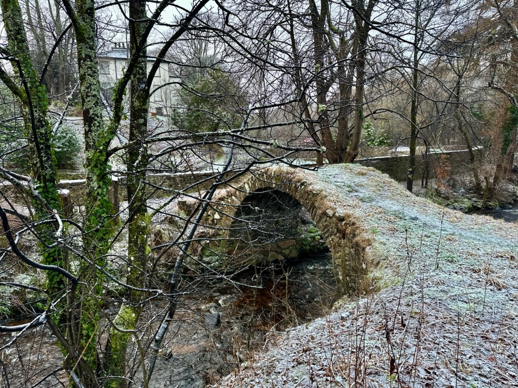
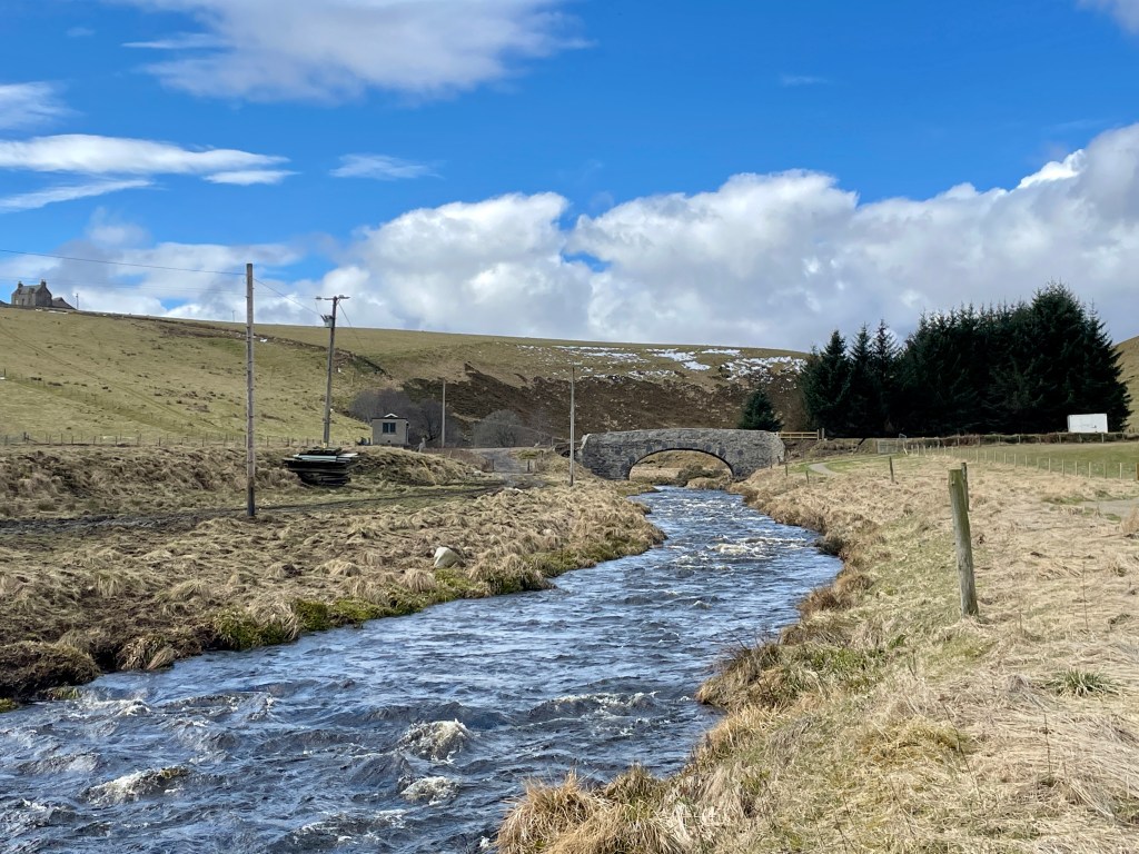
Once you reach the highest point of the hill, the descent will be a welcome relief. Soon, the Black Water River will come into view. Not far from the river, you will reach a way marker post—take the track to the right. This track follows the river. After a short distance, you will see Blackwater Lodge on the opposite side of the river.


As you approach the lodge, you will come to a fork in the track. Take the right track here—the left track leads to a ford, which cannot be crossed when the river is in spate. After a short distance you will reach a footbridge, cross it to reach Blackwater Lodge.

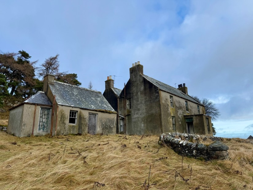
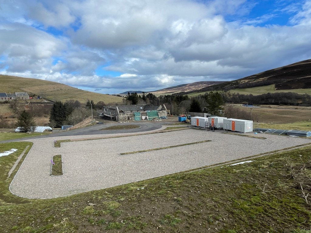
The lodge was a former seasonal hunting lodge, left unoccupied since the 1960s. Dating back to the late 18th century, it was used by the Duke of Richmond and Gordon. Please be respectful—only look through the windows and do not enter the property.

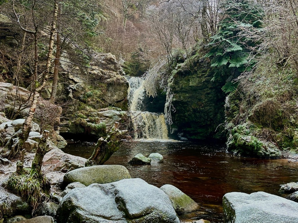
To the left of the lodge there is a small waterfall, a hidden gem that is worth taking a look. There are plenty areas to sit down and have a picnic and enjoy the peace. 


Once you have finished exploring, retrace your steps back over the bridge and along the track that runs parallel with the river.  At the way marker post, take a left to return over Dead Wife’s Hillock and back to The Steplar car park.

Moray Walks, New Walk, Places to Walk

Hiking up Ben Rinnes

Distance: 4 3/4 miles Time:2 1/2hrs – 4hrs Level: Moderate with lots of elevation. Access: Arrive by car. Parking available at the foot of the hill at AB55 4DA. No public transport.

Ben Rinnes is 841 metres high and is classed as a Corbett. It is a mountain so please be mindful of this and be prepared before setting off. Make sure you have suitable clothing, footwear, food and water. The weather can be very different at the bottom as it is at the top.

From the carpark head through the gate. Here you will follow the path as it meanders up the first small hill known as Round Hill. At the top of Round Hill, the path flattens out briefly. Then you start to ascend Roy’s Hill. You will continue on the well made path throughout.

As you reach the summit of Roy’s Hill, the path flattens out again. You will get a welcome breather before your final ascent to the summit of Ben Rinnes.

The last section is the most challenging with the mix of path and steps on the way up. This is a great opportunity to stop and take some photos. It will give you a chance to catch your breath.

When you reach the top, head round the back of the tor (large rock formation). Then climb the last wee bit to get to the summit trig point. If you are lucky enough to have a calm, clear day, you will enjoy stunning views across Moray. You can also see the Cairngorms on such days.

To ascend, you will retrace your steps down Ben Rinnes. Then, head down Roy’s Hill and Round Hill before returning to the carpark. This marks the end of the hike.

Moray Walks, Places to Walk

Cairn Cattoch, Archiestown

Distance: 5 ½ miles, Time: 2 – 2 ½ hours, Level: Easy, Terrain: Forestry track, narrow woodland paths and quiet village walking. Access: Arrive by car parking in the square parking area nearest the hotel AB38 70Q where the walk begins. There is also a M-Connect bus that runs from Elgin to Archiestown Monday to Friday.

This is a beautiful woodland walk with a gentle hill hike in rural Moray. The walk begins in the village of Archiestown which was founded in 1760 by Sir Archibald Grant of Monymusk. The well kept square has several information boards that are rather interesting reading on the history of this lovely wee village.

After you have explored the square, head up past the war memorial and go straight on. Soon you will leave the village and start heading towards the woods. You will pass one more house to the right hand side before you come to the forestry gate.

At the gate go straight on and you will begin the gentle climb up through the woods on the fantastic track which would also be suitable to cycle and even great for an off-road buggy. Make sure you look back as you are walking uphill as there are some amazing views of Ben Rinnes behind you.

You will pass by a few paths on your left but ignore these and carry straight on. There were plenty of birds in the trees as I was walking,

and I am sure there was plenty of wildlife that was most likely hiding from my dogs. I did have a look for frog’s spawn and other beasties in the ditches at the sides of the paths but unfortunately I didn’t spot any but maybe you will.

After about 1 ½ miles the path will start to curve to the left after another ½ mile there is a slightly rougher track to your right. Head up this track which will shortly take a turn to the right. Carry on until you come to the next junction.

Take the path that turns up to the left that is signposted to Cairn Cattoch, soon you will come to a stone with March carved into it. This stone marks the border between Knockando and Rothes Estates. This is where the Riding of The Marches comes from which was an old custom of a ceremonial procession usually by horseback to make sure the neighbouring estate has not encroached on the owner’s land.

(The next section of the walk is no longer suitable for a buggy or cycle)

At the March stone turn left and follow the very rough narrow track until you reach the summit of Cairn Cattoch where you will find a marker post and another March Stone.

There is a fantastic view of the countryside in front of you and the Cairn Uish wind farm to your left. After you have taken all your photos and had a snack you can retrace your steps until you come back to the Cairn Cattoch sign post.

Take a left here and start your gentle descent back down the hill, keep going until you come to a gate for the quarry.

Take another left here so you can skirt round the side of the quarry and pass by another gate at the opposite end of the quarry. Follow the track until the next junction.

Turn left at the junction and go straight down the track enjoying your final section of your walk in the woods until you return to the gate and shortly after you return back to the village.

Moray Walks, Places to Walk

Linn Falls Circuit Aberlour

Distance: 2 miles Time: 1hr Level: Easy Terrain: Sections of pavements and road, along with a section of forest path and track. Some steps and rough ground. Access: Arrive by car or public transport. Stagecoach No 36 bus runs between Elgin and Aberlour at regular intervals throughout the day. Car parking available at Alice Littler Memorial Park AB38

This short but beautiful circular route is based around Aberlour in the heart of Speyside. The walk takes you out of the town and into the woods. Following the woodland path, you will come to the stunning Linn Falls (Linn of Ruthrie waterfalls). On your return to the town, you will pass by the Aberlour Distillery before finding the hidden packhorse bridge.

Starting from the carpark. To the right of the play park, you will see the bridge with the path over it. Walk over the bridge and past the back of the old train station, heading towards the church. It is worth taking a look round the front of the station. There has not been a train here since the line east to Dufftown closed in 1971 but the station still looks amazing over fifty years on.

Back at the Church, go towards the square, cross over the main road and pass the Co-op on your left-hand side and head up Queen’s Road. Once past the Fleming Hospital on your right, you will see a sign for Glenallachie and Fairy Knowe. Follow the narrow path up on to the road turning right. Just past the street of houses, take the narrow road to the back of sheds. It is signposted to the falls.

At the end of the tarred, narrow road, you will come to a gate, pass through the gate and on to a woodland path. Stay on the main path, ignoring any paths that branch off. The main path will curve to the right, and you will descend steps with a handrail and soon see the beautiful double-cascading waterfall.

The area beside the waterfall is a popular wild dooking spot in the summer months and there is a great wee area where you can relax and have a picnic. There was snow covering when we visited so dooking and picnics was not an option.

Once you have explored the falls, follow the Burn of Aberlour round to the right and after a short walk you will pass Aberlour Distillery on your left which was founded in 1879 by James Fleming. Fleming left a lasting legacy in Aberlour building the Fleming Hall and then the Fleming Hospital. When you reach the main road, you can take a closer look at the distillery if you take the footbridge on your left.

Here you will cross over the main road, be careful of traffic as this road can be busy. Once safely across, look over the bridge and nestled in the undergrowth there is a small, old packhorse bridge that was built around 1624.

Take the path to the right-hand side of the packhorse bridge which will lead you back to the car park. Just before you finish your walk take a look down at the Victoria Bridge which is a suspension footbridge that was built in 1902 to replace a ferry that was previously in service. The bridge was also funded by James Fleming and initially cost a penny toll to cross hence it is often known as the Penny Bridge.

From here you go back to the carpark and the end of your walk.

Moray Walks, Places to Walk

Exploring Elgin

Distance: 3 miles. Time: 1½ – 2hrs. Level: Easy with some elevation, Terrain: Pavement, woodland and grass track. Access: Arrive by car, parking available beside the Elgin Town Hall IV30 1UL (parking £1 for the day). The stagecoach bus station is close to the start of the walk with great bus links throughout the area. 

This is a great walk which is easy to access during the winter months with plenty of notable historical places along the way.

Start the walk from the High Street Fountain on the Plainstones (IV30 1BW). Facing the war memorial head along the High Street.

Passing by the St Giles Church that dominates the High Street with its Greek style pillars. The church was designed by Archibald Simpson and built between 1825 and 1828.

Just behind St Giles Church you will find the Mercat Cross or Muckle Cross. These are found in many towns and cities and are a Scottish name for a market cross where historically the right to hold a regular market or fair has been granted by a monarch, bishop or barron.

Muckle Cross

Keep heading along the High Street until you get to the Muckle Cross pub, here take a left crossing over the road, go towards the Shop-mobility building and take the opening to the left. From here walk through the car park towards the two blocks of flats, here you will find a footbridge over the main road.

Once over the footbridge take a right passing by Grant Lodge and the Elgin Bowling Club heading towards the Cathedral that you will see in front of you.

Elgin Cathedral, is also known as the Lantern of the North, dating back to the 13th century. This beautiful building was almost completely destroyed in 1390 by the Wolf of Badenoch, today the Cathedral is open for tours, or you can admire from afar. To the left of the Cathedral, you will find the opening to the Biblical Gardens which is also well worth a visit.

Carry straight on and cross the bridge over the river Lossie, from the bridge take a left and pass by the chip shop heading into Kingsmill Court. You will see a large warehouse on the left, turn left beforethe warehouse in front of you will see a fenced path that runs along the side of the river.

Head along this path until you come to another bridge back over the river. Keep an eye out for wildlife on the river, I saw ducks and heron along the way. Once over the bridge, turn right and follow the path around Cooper Park passing by the Cooper Park pond, there are usually plenty of swans and ducks paddling in the pond.

When you get to the junction of the A941 take the underpass and carry straight on until you pass by the sports centre. Once the path reaches the road, cross over another footbridge to your right. Once over the bridge take a left and just follow the path alongside the river.

Mansion House hotel

You will get some glimpses of the impressive Mansion House Hotel along the way. You will pass by a closed off footbridge, carry on until you come to the new one. Head over the new bridge and turn left following the path, it will turn right until you eventually come out at a road.

Duke of Gordon Monument

Head along Hill Street once you pass the building with the map you will find the path up Lady Hill. Take the zigzag path until you reach the monument at the top that was built to honour the 5th Duke of Gordon. Next to the monument you will find the remains of Elgin Castle, and in front of you a fantastic view across Elgin.

Elgin from Lady Hill

From here take the steps to your left, back down to the street, turn left and head back to the start of the walk. Just before you head along the High Street you will find a bronze statue of Alexander Stewart also known as the Wolf of Badenoch who set the Cathedral alight.

Wolf of Badenoch

Once back on the High Street it is time for a well-deserved coffee and cake!

Moray Walks, Places to Walk

Braehead, Cottage Woods and the Auld Brig, Keith

Distance: 4 miles Time: 2 hrs Level: Easy Terrain: Pavement, rough road, woodland and grass track. Access: Arrive by car, parking is available in Reidhaven Square, Keith, AB55 5AB where the walk begins. There are regular buses running between Aberdeen and Inverness that drop off and pick up in the Square.

This beautitul walk starts not far from my home in Keith and soon takes you into the countryside, heading along quiet roads, a walk in the woods and passing some fascinating historical places along the way.

Starting in Reidhaven Square and head up Chapel Street towards St Thomas Church the Roman Catholic Church was designed by Walter Lovi, a catholic priest and architect, and William Robertson a well-regarded architect based in Elgin. It was completed in 1832. The large copper dome was added in 1916 by Charles Menart. Pass by the left hand side of the church and head straight on.

At the junction follow the blue waymarked sign and head left then take the next right, then go straight on until you come to the green waymarked signs. Here you take a left along the grass track. The path can get muddy if it has been wet. As you follow the path, if you look to the left you will get great views of the countryside, the River Isla and the track for the Keith and Dufftown railway.

When you reach the road turn right and take the road on your right passing by the house and yard before heading down the brae until you arrive at River Isla. To your right hidden in the undergrowth you will find the ruins of the former Flax Mill. Before the Distillery act of 1824 was introduced, illicit distilling and smuggling was verv popular and between 1790 and 1803.700 people in the area were fined for offences relating to distilling and smuggling. In 1790 John Taylor, the owner of the now ruined flax mill was charged with retusing to produce keys to his mill. He possibly didn’t want to get caught in the act!

Head over the footbridge and continue straight on. Follow the road until you arrive at the junction. Cross over the road and go straight on following the signs for Cottage Woods. Please be careful in case there are any venices on the road, although it is quite a quiet stretch of road between the got course. There are several openings to your right along the way but ignore these until you come to the opening with some steps.

Go up the steps and onto the woodland path. Follow the path straight on enjoying the beautiful peaceful Cottage Woods. The path will turn to the right and go uphill slightly until you come to the waymarker and the opening at Regent Court. Take the path that runs along between the houses and the golf course. Go over the small footbridge to your right and follow the narrow path through the trees until you reach Mar Court.

Take a left here and at the Fife Street junction take a left and go towards Regent Square. At the square take a right down Regent Street passing by the shops until you reach the Auld Brig. The Auld Brig was built in 1609 by Thomas Murray and his wite Janet Lindsay. It was said to have been erected in memory of their son who drowned while crossing the ford. The Brig has had several repairs over the years, and the steps were added in the 1900’s.

As you walk down the steps, look to your right, you will see a large stone that covers a small opening, this is known as Campbell’s hole. This is where the Hanovarian Campbells took retuge from the Prince Charles Jacobites after a battle in 1746. During the extension of the nearby kirkvard, there was a communal grave found that had been named locally as Campbell’s Hillock.

The Union Bridge you see to your right was built in 1770. Under the bridge there was a stone or “Scaur” where alleged witches were thrown into the deep pool of Gaun’s pot. If the “witch” survived they would then be later burned.

Once over the bridge take a left and then a right passing between the graveyard and the shop. Then take a left and head along the road that runs over the railway track. Take a right here and walk along to the end of Old Toon until you get to the grass track.

Head up the grass track until you return to the junction you started at from. Go left here following the road back to the St Thomas Church then Reidhaven Square and the end of the walk.

Moray Walks, Places to Walk

Burghead and Clarkly Hill Circuit

Distance: 4 ¾ miles Time: 2hrs Level: Easy with some elevation Terrain: Mix of pavements, coastal trail, woodland trail, and country road. Access: Arrive by car, parking available at the opening of the caravan park. Follow the signs for the caravan park and use the car park on the left-hand side using postcode IV30 5RP. There is a No32 Stagecoach bus from Elgin that drops off not far from the start.

This beautiful walk on the Moray coastal trail takes you along past the harbour and on to the old railway line path with a stunning coastal view and a chance you may see dolphins passing by. There are an abundance of historical sites along the way with great information boards!

Route: Leaving the car park follow the path that takes you along to the harbour. The harbour itself was built by Thomas Telford in the early 1800’s with impressive three storey warehouses. Three of the warehouses still remain and have now been converted into flats.

Once you pass by the warehouses take the stairs up to some great views of Burghead bay. Turn right along to the visitors’ centre in the old white round building, here you can find out about Pictish Burghead dating back to 400AD.

Once you have explored the centre, head towards the old anchor and you will see the Clavie mound. This is where on the 11th of January every year Burghead celebrate their New Year with a unique fire festival called the burning of the Clavie. The significance of the 11th January dates back to the 1750’s

From the Clavie mound, head towards the waterside and turn right along the tarred road, where you will find the Harvest Reaper boat that was originally built in Fraserburgh in 1931 and was finally berthed here in 2015. There are always plenty of seabirds to look out for as you walk along the water’s edge.

Further on you will pass by the Maltings and on to the coastal path. You will come to St Aethan’s Well and onto the disused quarry.

There are several way markers for the Clarkly Hill short walk, ignore these. You will pass under an old railway bridge before coming to the Cummingston Crag. The sandstone crag is a popular sea cliff for mountain climbers, and you may see some climbing the Prophet Walls (as it is known) as you are walking past!

Once under the second old railway bridge you find an opening on the left-hand side; this path will double back before going over the top of the bridge. Head straight on here until you arrive in Cummingston.

At the junction you will see the sign post a little to the left for Clarkly Hill. Cross over the main road and up the country road ahead. Looking over to the left and you will get some great views of Hopeman in the distance.

You will soon come to your next way marker taking you onto a track on your right. This will take you past a pig farm before coming to your hext sign post. Here you will go through the gate and straight ahead into a wooded area.

The viewpoint is unfortunately overgrown now, turn right at the fence and follow the path through the wood till you come to the gate at the other side.

From the wood you will carry on down the road back towards Burghead taking in the views ahead. Once past the masts go through the gate and back to the main road. Cross over and turn left here until you come to the junction to turn right, back in to Burghead.

Follow the main road back until you come to the community gardens. From here turning left to arrive back at the carpark.

Moray Walks, Places to Walk

Through the Green door, Fochabers

This is a lovely short walk round the Lake at Gordon Castle. The green door leads you to the castle grounds where you will find the lake with paddling ducks! Great walk for all the family and short enough for little legs!

The Green Door

Distance: 1 1/2 miles Time: 45 minsTerrain: Mix of grass path and tarred road Access: Arrive by car parking available in Fochabers Square, Moray IV32 7DF. There is also regular no 35 and no 10 Stagecoach buses that drop off and pick up the in square.

Route: From the square head for Duke Street that is to the right of A J Jamieson Butchers and you will see Gordon Chapel straight ahead.

Gordon Chapel

At the chapel you will see the dark green door on the left. Go through the door then take the path to to the left. Keep going till you come to the castle opening. Take a right here over the bridge.

Gordon Castle entrance

Once over the bridge follow the road ahead till you come to a fork take the road on the right. Then take the next right that is sign posted for the Lakeside cottages.

The Lake

You will soon come to the lake. Here you can follow the path all the way round watching the paddling ducks and enjoy!

Once you have walked round you could head along to the Gordon Castle gardens, cafe and shop which is just a little further on the right hand side. To return to the square just retrace your steps back to the bridge and then to the green door.

Moray Walks, Places to Walk

The Discovery Trail at Cabrach Trust

The discovery trail is a fantastic nature trail on Inverharroch Farm that the Cabrach trust purchased in 2013. The beautiful trail opened in 2022 and sits on the edge of the Deveron and Blackwater Rivers.

Distance: 2kmTime: 45mins Level: Easy Terrain: Well kept path Access: Parking is available at the Acorn Centre. It is easy to find coming from Dufftown or Rhynie at Lower Cabrach, Cabrach AB54 4EU

Leaving the carpark go past the information board and head towards the the small renovated building and turn left here you will join the discovery trail.

It is an amazing path that is buggy friendly that will take you along to the pond first that you can walk all the way round. Before heading along to the bird hide. That just sits on the edge of the river.

Remember to look up and down as we spotted a stoat, buzzards and hares. Keep along the path and you will find a lovely picnic area before you come to the Blackwater bridge.

From the Blackwater bridge we turned right and went through the gate on the right to head up to the bunker on the hill. You also get a great view of the distillery there too!

To return you just retrace your steps and back to the carpark.

https://cabrachtrust.org/