

Distance : Approx 4 miles. Time : 2hrs. Terrain : Pavements, road and riverside paths that may be muddy so wear sensible footwear. Access : Car parking is available at Burn Lane car park AB51 3SH that is just round the corner from the start of the walk (Car Parking is a couple of pounds). There are regular buses from Aberdeen to Inverness that stop outside the town hall at the start of the walk. The train station is only a short distance away.
Inverurie is one of the largest towns in Aberdeenshire and is packed with plenty of independent shops. Only a short walk from the town centre, you will find yourself in the countryside, with numerous opportunities to discover interesting historical sites along the way.
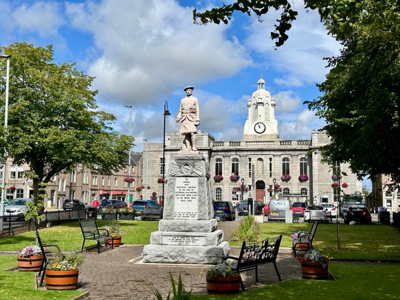
Start the walk from the Town Hall, heading across the road to the triangular-shaped Garden of Remembrance and War Memorial. Continue along the High Street until you reach the fork in the road. Take a right here onto St James’s Place and keep going until you reach the roundabout. Cross over the road at the island, and you will find the entrance to the riverside paths on your left. Walk down to the riverside and take a left under the Don Bridge.

Before 1790, Inverurie could only be reached by a ford across the River Don. The bridge that stands now was built in 1924. When I was there, I was greeted by many ducks. I’m not sure if they were hoping I had something for them to eat.
Keep following the path. Some areas are narrow and a little overgrown, so be careful along the way. Once you reach the railway bridge, head under it. You will now be in an area called the Stanners. This is the earliest site of habitation in Inverurie, where Bronze Age artefacts have been found. The townspeople gradually moved to Inverurie’s present location to avoid floods. Follow the narrow path that runs along the riverside. The path eventually turns to the left, continue until you reach the wooded area.
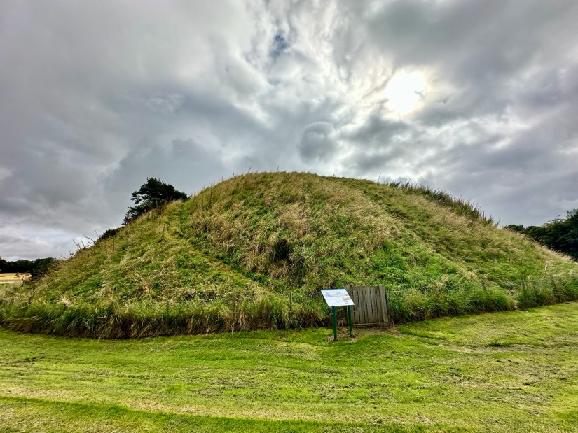
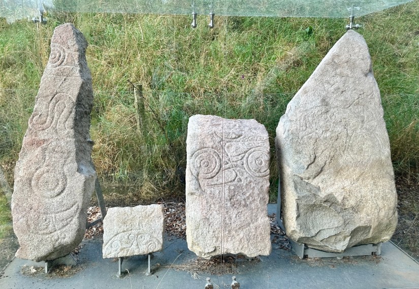
When you come to the bridge, take a left until you find the opening in the fence on your right. Be careful here as this takes you onto the road. When it is safe to do so, cross the road and go through the gates into the cemetery. You will find two large mounds known as The Bass. These were formed from melting ice during the Ice Age. A motte-and-bailey castle was built on top of the Bass in the 12th century by the Earl of Huntingdon. The mound was reshaped and cut in two in the 1800s; the smaller mound is known as Little Bass. Between the mounds, you will find four Pictish symbol stones dating from 400-900 AD. They are said to have been found built into the walls of the old parish church.
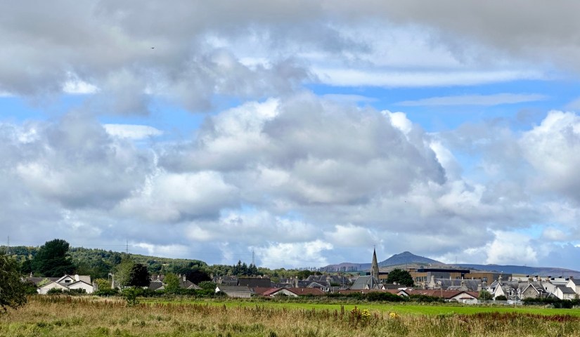
Beside the Bass, there is an opening in the wall where you can get back onto the path. Keep following the side of the cemetery wall until you return to the riverside path. Take a right here, and you will soon come back to the waterside. A path winds its way along the River Urie, I spotted swans on the water along here and a sparrowhawk in the trees. The river will take a left turn, and you will come into a wooded area. Here, you will find a path that turns left and heads back into the town. You will get an excellent view of Inverurie with Bennachie behind it.
Follow this path until you reach the railway crossing and when it is safe to do so, go through the gate and cross the line. Go straight ahead, passing the car park, houses, and buildings, until you return to the High Street. Take a right to return to the Town Hall and the end of the walk.
